Details
Region: Central Columbia Gorge
Location: Ryan Allen Road in Stevenson, Skamania County, WA
DEN Rating: 7/10
Trail Length: 1/2 mile total
Trail Type: out and back
Hike Time: 8-15 minutes one way
Trail Difficulty: easy 2/10, with one steeper 6/10 section
Trail Surface: gravel, wood stairs, solid rock
Popularity: 2/10
Family friendly: yes for older kids
Pet friendly: no
Handicapped Accessible: no
Swimming: yes (swimming hole info at end of article)
Camping: no
Restroom: none
Season: year-round (easier access in dry season)
Pass or Permit: none required
Managed by: City of Stevenson, WA
Select photographs in this article are available as custom prints. Click on the shopping cart icon to see print media and sizing options. Click on the square icon for a full-screen view of the image.
Upper Rock Creek Falls is a wonderful waterfall found on the edge of the fantastic town of Stevenson, WA. The falls are relatively undiscovered – known mostly to locals. The land is owned by the city, and how the falls are accessed has changed in recent years. The old view was found at the back of Iman Cemetery and looked down on the scene, but this has been closed off and the view is not accessible anymore. A new trail has been creatively constructed that actually gives much better access and a totally different view, as well as making swimming at this falls now possible in the summer.
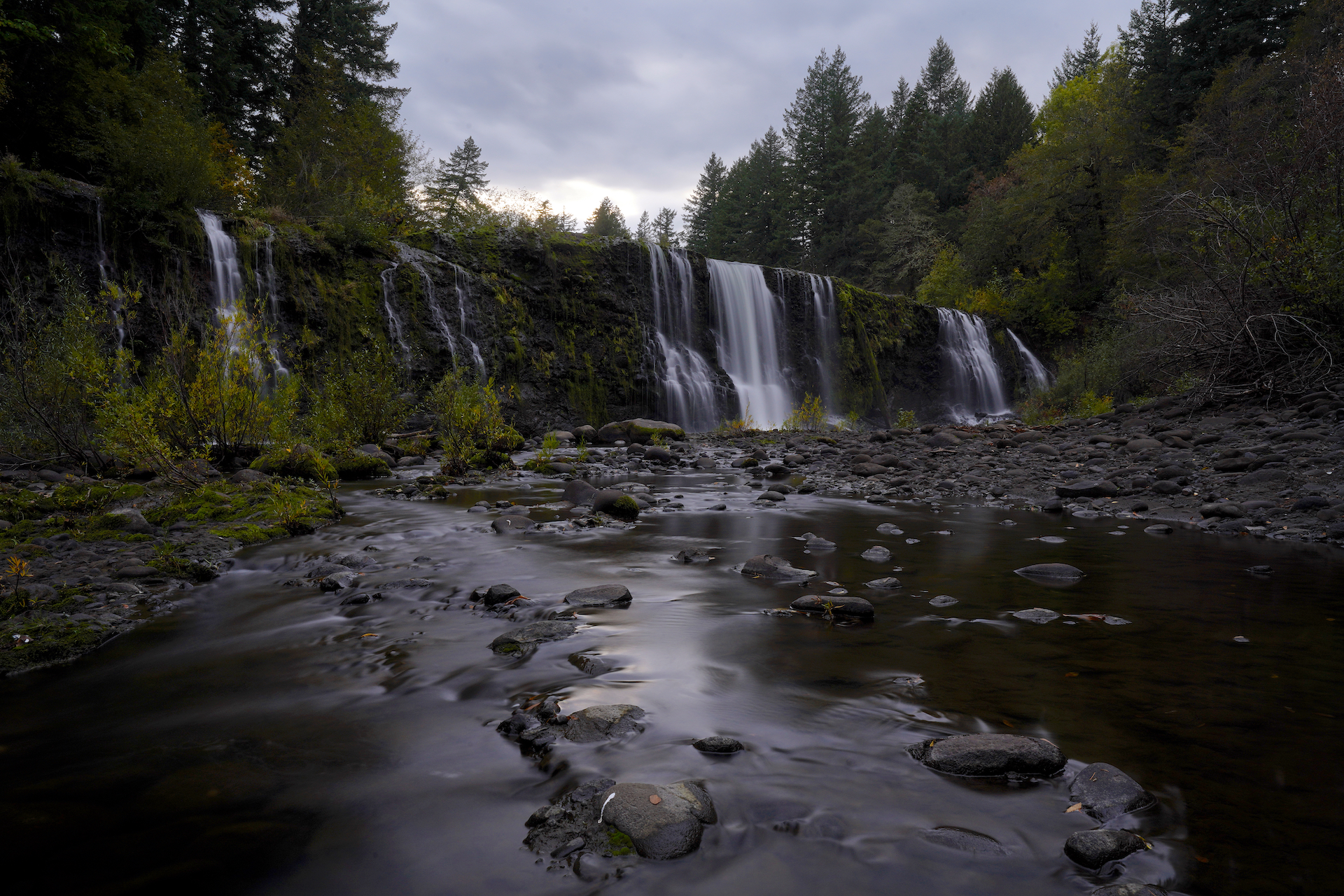
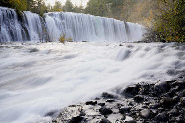
Rock Creek is a big waterway, with a streambed that’s wider than that of many local rivers. Upper Rock Creek Falls occurs where a 40-foot tall rock wall runs diagonally across the canyon. The resulting waterfall is a staggering 150-foot wide block, with cataracts dropping over the ledge in clusters. In late summer the central cluster contains about 2/3 of the water, with 1/4 falling in a second cluster on the far left and the remainder sneaking down the far right corner. At moderate flows more cataracts develop across the ledge. At high flows the cataracts merge into one massive sheet and the entire canyon fills with wall-to-wall rapids.
A New Niagara
Upper Rock Creek Falls outside of Stevenson, Washington, is the most dynamic waterfall I’ve ever seen. Six weeks before taking this photo I visited here to find a nearly dry cliff with three little channels of water falling over it, spaced very far apart. Fast forward to early November after a few days of heavy … Read more
The streambed below the falls is a formation of solid conglomerate – lots of smaller rocks cemented together. When the flow is on the lower side it’s really easy to explore the canyon bottom and there’s tons of space to hang out. The hidden pocket on the far right is a pretty cool flat area, and there is a decent swimming hole at the center falls cluster. At moderate flows the streambed becomes a network of small pools and shallow flows (bring rain boots if you want to get close to the falls), and at high flows the rocks become fully submerged beneath rushing water.
The gravel trail is quite easy, descending gently and evenly through an open field with a lot of blackberries (they were cut back when I visited.) Near the end of the trail someone has creatively done their best to make an access out of the materials they had. You’ll descend down a short set of steps made of metal bars that look like they were once part of a schoolyard play structure, followed by an improvised bridge made of pallets which is tilted and wobbly but there is a rope to hang onto. The final stretch is a series of skinny stairs with ropes, found where the trail makes it’s descent to the creekbed. Unfortunately all of the wood they used is getting soft and rotten. Some of the steps have broken which makes this final bit a little tricky depending on your level of nimbleness. I found coming back up these steps to be much easier than going down. The trail ends at the creekbed about 200 feet downstream from the falls.
This trail I just described is a new route to the falls, constructed during the Covid-19 pandemic and finished in 2021. Since then the old access through Iman Cemetery has been closed off. The new route is all on land owned by the City of Stevenson and is the “official” (yet unsigned) access to this impressive waterfall.
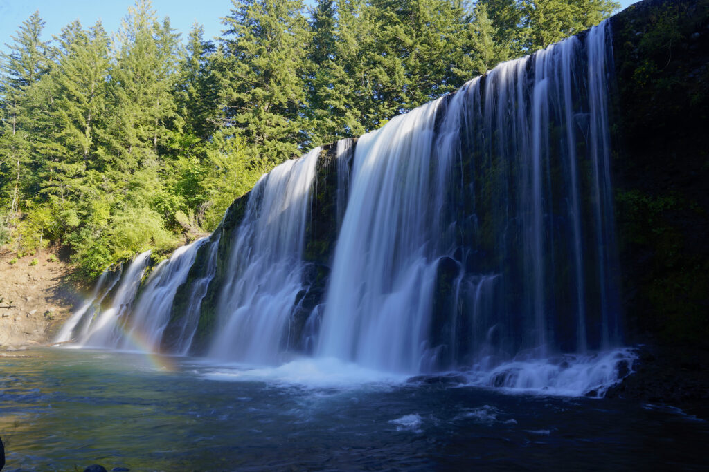
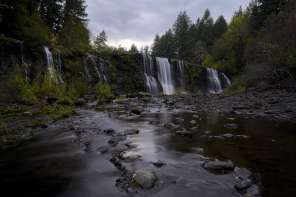
This is a really cool waterfall. It’s immensely wide, which makes it quite different from most northwest waterfalls. It’s also very open – there are no trees in the creekbed area. In summer this is a great spot for swimming, soaking up the sun, and hanging out with friends, although the falls are pretty lackluster. In the wet season when the flows are high this waterfall transforms into a magnificent thundering wall of water. The transformation this falls goes through between high and low flows is the most exaggerated I’ve seen. Personally my favorite is when the falls are at a moderate flow because there’s a nice balance between accessibility and scenery, plus the pools that form at medium flows create picturesque reflections.
Some locals hang out here in the summer, yet you’ve got a good chance of having this spot all to yourself on cooler days and in the morning – pretty much anytime that swimming isn’t appealing. I’ve visited four times and only once were there other folks there. Please be responsible if you visit this incredible falls by packing out your trash and heading out someplace else to use the restroom.
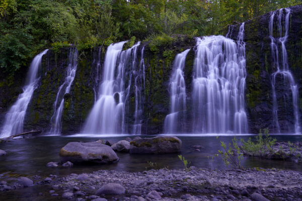
Rock Creek Falls breaks up into many cataracts as water levels drop in summer. By September this section of the broad cliff face is mostly dry.
Rock Creek Beauty Pageant
140-foot wide Upper Rock Creek Falls splits up into a series of cataracts as water levels drop in summer, each one competing for the prize of most photogenic. The western five are shown here on a warm July evening with many more waiting out of shot to the right. Want to visit Upper Rock Creek … Read more
Cautions
The improvised bridge is a little sketchy – it’s slanted, it flexes underfoot and it teeters a bit. It’s definitely rotting. There is a strap tied to the trees to hang onto as you cross. My advice is to go one person at a time. The skinny stairs with the missing steps were well-designed but are a little more challenging to negotiate now that they have fallen into disrepair. They look more treacherous than they actually are. Your average 10-year-old should be able to make it down. Dogs will have trouble getting down the stairs. My advice is to go down the stairs backwards, one step at a time, and use the rope as you go – “repelling style.” The soil is extremely soft where the final stairs lead down to the creek and it gets muddy during the rainy season. A big cedar branch has fallen just before the end of the trail which also requires getting through. As you go down the trail you’ll pass fairly close to a house with a big dog who is sometimes outside and can get to the trail. Just be aware and follow common sense rules about dealing with unfamiliar and potentially unfriendly dogs.
Swimming Hole Info
Upper Rock Creek Falls has a decent pool at the base of the central cataracts, with easy access. The water itself is more cloudy than many swimming holes in the area, with a dull blue-grey tint to the water and clarity of only 3-6 feet, sometimes less. The pool is deep enough and big enough for swimming. Do not attempt to climb up and jump off the ledge into the pool – the water is not clear enough to see submerged rocks, which are numerous.
- summer water temp: cool – 64F – 72F
- water clarity: 3-6ft
- color: dull, dark blue-green
- Depth: 10-20ft
- Current: 0-1
- Shoreline & stream bottom surface: solid chunky and irregular rock, can be slippery
Getting There
From Skamania Lodge in Stevenson, head north on Rock Creek Rd then make a soft left onto Foster Creek Rd, which will become Ryan-Allen Rd. Follow Ryan-Allen up and around, eventually crossing Rock Creek. Park at the red fire hydrant on the right about 1/2 mile past the bridge, just before Aalvik Rd T-s in on the left. There’s room for 4-5 cars. The path starts right next to the hydrant, passes through a meadow filled with blackberries, crosses a wide area that looks like an old road, then continues through a second field before dropping down to the creek via the rustic stairs and bridge. The entire trail is about 1/4 mile and takes about 7-10 minutes.
Photographer’s Tip
There is a lot of space to move around at low flows but almost none when the creek is running high. I used a wide-angel lens as well as a 24-70mm lens. There are no trees behind the lip of the falls so the sky can look bright and over-exposed behind the waterfall. If you’re shooting in sunny conditions or even on cloudy afternoons you’ll want a neutral-density filter. The falls are so wide that getting the entire falls in one shot is nearly impossible except for right where the trail lets out. At low flows a nice reflecting pool forms near the far right upstream corner of the canyon. At moderate flows a pair of waders or rain boots will help you get much closer to the falls.
Foreboding
Moody clouds gather in an October evening sky above Upper Rock Creek Falls just outside of Stevenson, Washington, creating a sense of foreboding. My glasses fell out of my pocket on my way back to the car after capturing this dark image, causing me to spend an extra hour backtracking to find them with only … Read more
Links
https://outdoorproject.com/united-states/washington/rock-creek-falls
Outdoor project has photos of and directions to the old access at Iman Cemetery. This access is now closed. Follow my directions above.
https://www.waterfallsnorthwest.com/waterfall/Upper-Rock-Creek-Falls-5195

