Details
Region: Mt Hood
Location: Hwy 35, between Sherwood Campround and Klinger Springs – about 8 miles north of the exit to Mt Hood Meadows Ski Area / Bennett Sno Park
DEN Rating: 10/10
Trail Length: 3.4 miles total (1.7 miles each way)
Trail Type: out and back, longer hikes possible
Hike Time: 45-75 minutes to falls
Trail Difficulty: moderate 5/10
Elevation Gain: 580 feet
Trail Surface: dirt, becoming rocky as the trail progresses
Popularity: 6/10
Family friendly: yes
Pet friendly: yes
Handicapped Accessible: no
Swimming: no
Camping: backpack campsites trailside
Restroom: vault toilets at trailhead
Open Hours: 24 hours
Season: June – Oct
Pass or Permit: $5 parking fee per day, payable cash or check at trailhead
Managed By: US Forest Service
Select photographs in this article are available as custom prints. Click on the shopping cart icon to see print media and sizing options. Click on the expand icon for a full-screen view of the image.
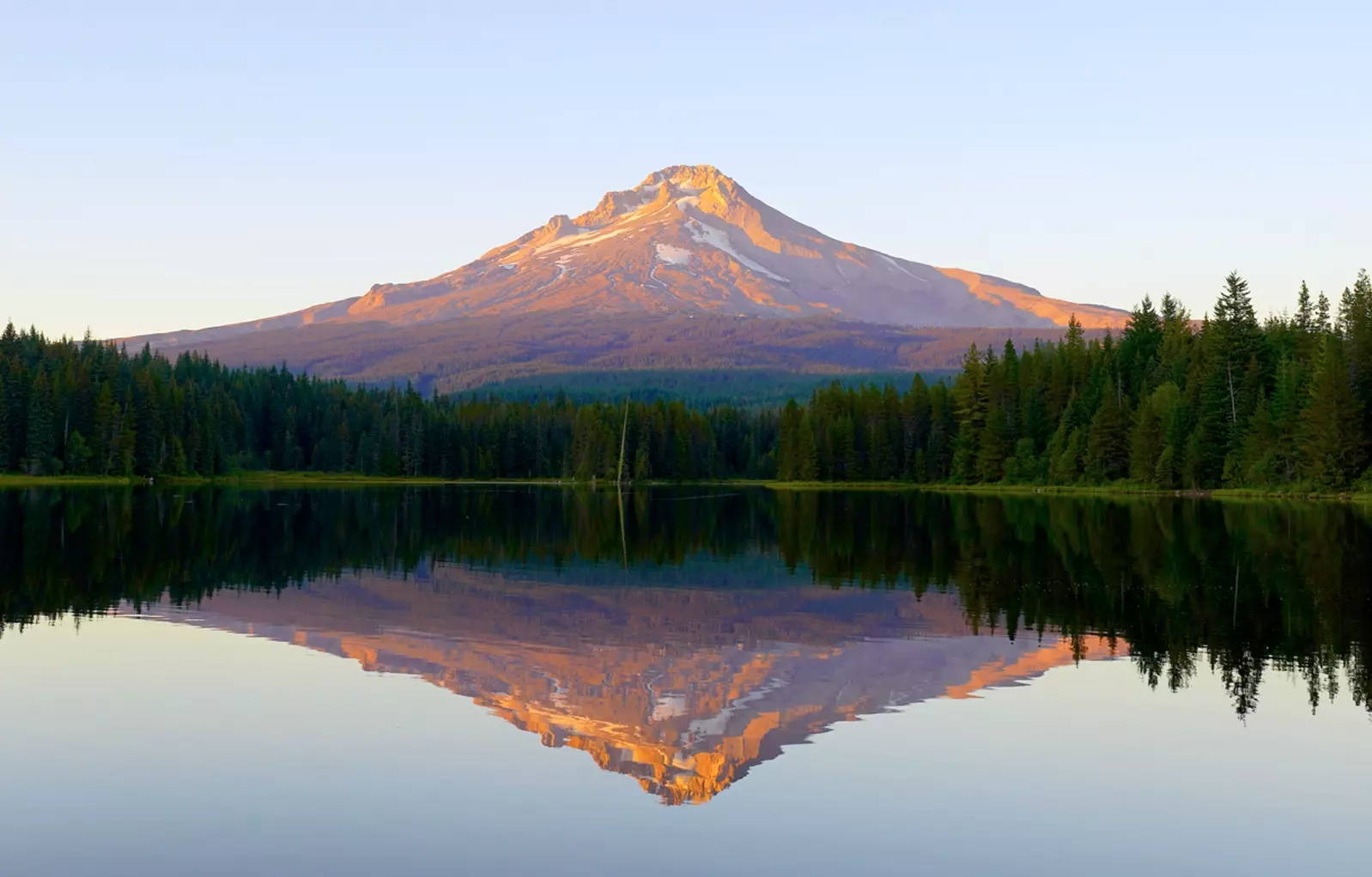
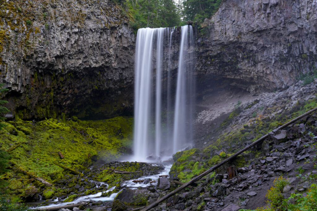
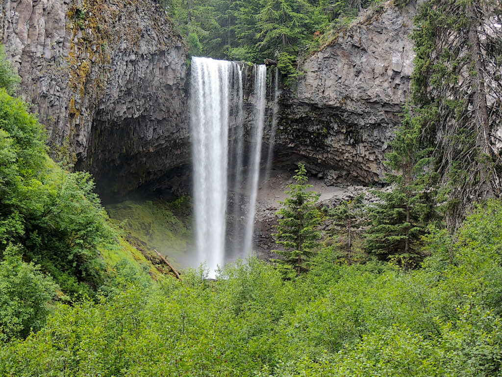
Tamanawas Falls is the crown jewel of waterfalls in Mt Hood National Forest. Plunging 110 feet mightily off the eastern slopes of Mt Hood into a massive stone cathedral carpeted in emerald moss, Tamanawas Falls is the only really epic waterfall in the northern Oregon Cascades. Add to it the fairy tale forest hike en route to the falls and this site gets pushed to the A-list of Oregon outdoor attractions.
I think of this hike as having two distinct segments – the river section followed by the creek section. The journey begins by crossing a slender wooden footbridge over the sediment-laden East Fork Hood River. Turn right after the bridge and follow the Hood River Trail downstream through a pretty riverside forest. The trail rises and falls a few times as it climbs away from the river through a less scenic section of forest with little undergrowth. Stay left at the trail junction as the trail approaches the creek. A few hundred yards later the trail crosses another solid footbridge, this one over beautiful Cold Springs Creek.
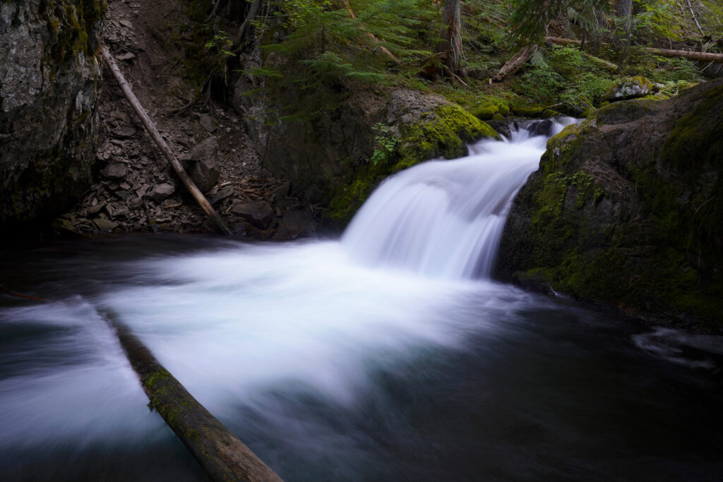
From here the trail turns left and heads up the creek canyon. It’s very pretty in many places, with the creek babbling and tumbling trailside and the green forest shading the trail. Certain spots look like they could be the entrance to a ride in Disneyland or a setting for a movie. En route you’ll pass a beautiful flat next to a calm section of creek that would be a perfect backpack campsite (except there’s no established fire ring), a second flat with a tree’s web of roots exposed, a few trailside log benches for viewing a tall cascade, and a very pretty four foot ledge drop with a bubbly pool. By this point the trail’s grade has become a bit steeper. After this you’ll pass by a small slope of rock rubble.
The final approach passes up and through a significant rockslide and is easily the most difficult section of trail. Take the left trail where the rockslide begins. There are a few different routes through the rockslide – look for rock steps and short switchbacks on the right near the far end of the rockslide since what appears to be main trail gets pretty steep. You’ll reach the falls about 500 feet beyond the rockslide, with a really nice view of the falls opening up before reaching the falls cathedral – go left at the trail junction where you first view the falls.
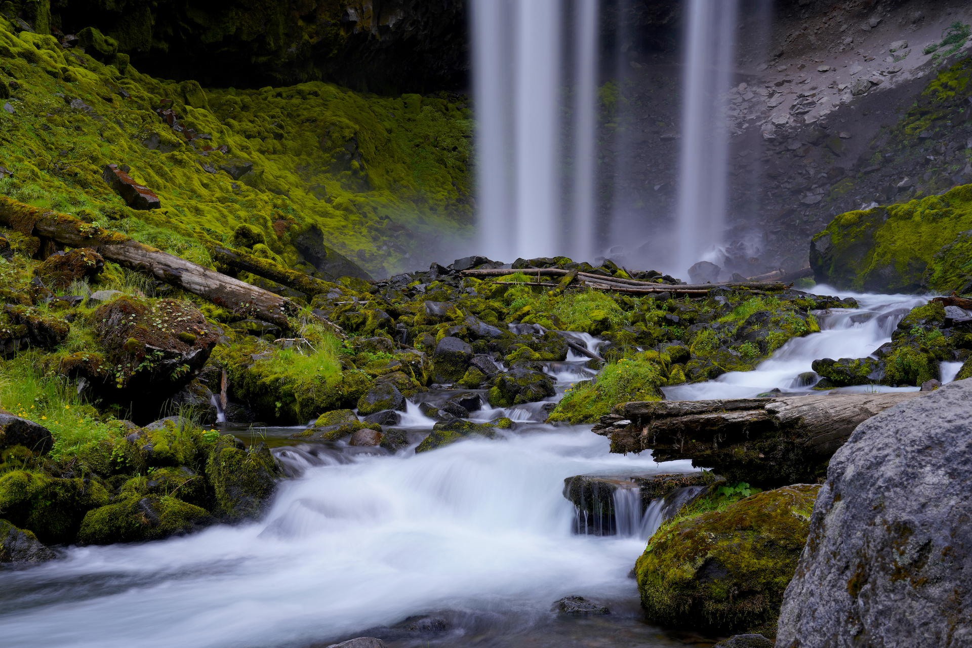
Tamanawas Falls is grand, both tall and wide with a big undercut behind it. It creates clouds of mist which blow along the amphitheater walls, carpeting all in it’s path with verdant mosses and wildflowers. When flows are high it’s one massive sheet, but at lower flows the falls breaks apart into a few different cataracts, like a smile with a missing tooth. A web of scramble paths lead out from the flat area by the creek which serves as the official viewpoint and trail’s end. Pika and golden mantle ground squirrels peek out from between the rocks and scurry about around the trails end. A scramble path leads up the rock rubble, then turns ahd traces the cliff base, eventually passing behind the falls. When the water is lower (we visited in early August) there is an easy rock hop across the creek to an island oasis which is far less misty (much easier to photograph from here) and has a perfect logs and rocks for a picnic or a spot to relax.
I very highly recommend the Tamanawas Falls hike. It’s a wonderful journey with lots to discover along the way, and the falls at the end are awe-inspiring. Be aware this is a fairly popular hike. On our second visit we went late in the day and were lucky enough to have it all to ourselves. Also know that this is a fee area ($5 per vehicle per day – cash or check) and I do not believe that a NW Forest Pass is accepted. If you’re looking for a good half-day hike, don’t miss Tamanawas Falls! For me this is one of the top 10 falls in the state!
Tamanawas Moss Garden
Emerald moss blankets everything the mist touches below mighty Tamanawas Falls on the east side of Mt Hood, Oregon. Tamanawas Falls is a grandiose scene unmatched in the Mt Hood area. At lower flows the falls breaks up a bit, forming stripes as it descends. The falls base is particularly photogenic, especially as viewed here … Read more
Cautions
There is one spot in the river section of the hike where the trailside dropoff is quite tall. Once you’re on the creek section there are no scary dropoffs. You’re at too high an elevation for poison oak so that’s not a worry. There are a lot of rock steps so expect a bit of stumbling and be sure of your footing. The soil is volcanic ash and pulverized rock and it gets dusty when it’s dry and possibly slippery when it’s wet. There are a few muddy spots where springs cross the trail. One has a delightful little rustic bridge built from thick tree bark over it that feels like Tom Sawyer’s Island or something from the old west. Be careful when crossing the rockslide – the rocks are solidly in place but are irregular, sharp, and potentially slippery. During snowmelt, when the water is high, the falls produce a tremendous amount of mist, which makes all the rock surfaces wet and possibly slippery in the falls amphitheater. Be careful not to trample mosses and native plants when exploring around the falls base. This is a warm-season hike only. Also, the distances marked on the forest service signs along the trail are not accurate, just ignore them.
Getting There
Tamanawas Falls trailhead is found on the west side of Hwy 35 between Government Camp and Hood River, about 1/4 mile downhill from Sherwood Campground and 1 mile above Klinger Springs. If you’re coming from Portland, it’s shortest to take Hwy 26 past Govenment Camp then take Hwy 35 north. From Bend, take 97 north to 26 west to 35 north. If you’re coming from Hood River or The Dalles, just take Hwy 35 south. You can use Google Maps, it will reliably take you to the correct spot. There are always a lot of cars in the long roadside parking area. On the trail, it’s go over the bridge and go right, then go left at the junction just over the creek bridge, then left at the trail junction when the falls first come into view.
Photographer’s Tip
Photographer’s Tip: The falls face north and are backlit around midday – expect deep shadows in the undercut behind the falls. In the later afternoon the falls are in even, open shadow and it’s much easier to see into the undercut. The biggest problem here is the prolific mist from the falls, especially when the water is high. There’s a prime spot on the little island that’s out of the spray. The creekbed below the falls is very photogenic. Also, take your time on the hike up to the falls as there are many quiet forest scenes and pretty cascades in the creek deserving of some attention as well.
Links
https://www.fs.usda.gov/recarea/mthood/recarea/?recid=53300
https://www.alltrails.com/trail/us/oregon/tamanawas-falls-trail
https://www.oregonhikers.org/field_guide/Tamanawas_Falls_Hike

