Details
Region: Central Oregon
Location: Crooked River Rd, Terrebonne, OR 97760
DEN Rating: 9/10
Trail Length: varies
Trail Type: varies
Hike Time: varies
Trail Difficulty: varies, most are easy
Elevation: varies
Trail Surface: mostly loose, sandy gravel, paved areas, steps
Popularity: 10/10
Family friendly: yes
Pet friendly: yes
Handicapped Accessible: yes to picnic area, no on almost all trails and viewpoints.
Swimming: no
Camping: walk-in tent sites
Restroom: flush toilets, vault toilets
Open Hours: day use only (dawn to dusk) excluding camping area
Season: year-round
Pass or Permit: $5 day use fee or Oregon State Parks pass
Managed By: Oregon State Parks
Select photographs in the article are available as custom prints. Click on the shopping cart icon to see print media and sizing options. Click on the square icon for a full-screen view of the image.
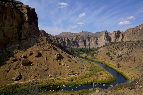
The north-facing / upriver view from the picnic area on the canyon rim is one of the best in Smith Rock State Park.
A River Winds Through It
The little Crooked River winds through it’s desert canyon in Smith Rock State Park on a golden August afternoon. The ecosystems, landscapes, and stunning rock formations in this jewel of a park rival those of more famous parks in Utah and Colorado in terms of rugged beauty, but originated from very different geological forces. To … Read more
Smith Rock State Park is an epic destination in Central Oregon’s beautiful desert landscape. Big and beautiful, Smith Rock is an internationally-known rock climbing destination and a magnet for hikers and mountain bikers, as well as families looking for an easily accessed park and trails with magnificent scenery. For me this is one of the top three Oregon State Parks and a place that everyone, resident and visitor, should spend some time exploring.
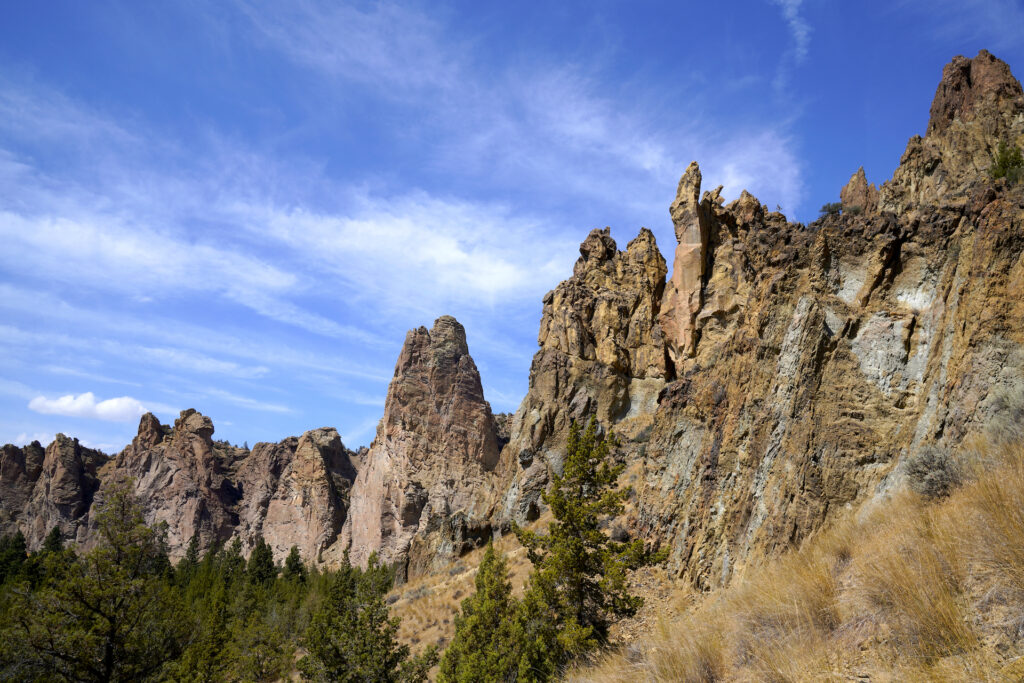
The Smith Rock formation is made of tuff, an igneous rock made from compressed volcanic ash. Over millions of years the tuff eroded into the rugged, craggy shapes we now see, some of which tower 600 feet. Millions of years later, basalt flows encroached from the south, pushing the Crooked River up against the Smith Rock formation and creating the canyon we see today, with very different rock on either side of the river. Geology like this is fairly rare and is another reason why Smith Rock is a standout in the Pacific Northwest. It also created the perfect conditions for an easy-access park as the road, parking, camping, and picnic areas are all on the flat-topped basalt side of the river along with the park’s easiest trails.
In terms of human history, the Smith Rock area is the traditional homeland of a few different Native American groups, including the Tenino (Warm Springs) and Northern Pauite, who referred to the canyon as “Animal Village” due to it’s abundance. Contact with people of European ancestry began with trappers in the 1820s. Local settlement increased in the 1860s due to the nearby John Day goldrush. Hostilities led the Northern Pauite into a battle here in 1863, wherein a young US Army soldier named Private Volk Smith fell to his death. Accounts vary of what exactly happened, but his death here may have resulted in the formation being named in his honor. The other contender is John Smith, an early arriver Oregon who has been credited with “discovering” the rock formation. John Smith served as a sheriff in neighboring LInn County in the late 1850’s, then as a US senator for a few years before becoming an Indian agent to the Warm Springs Indian Agency for twenty years. The land for the park was acquired in 1960, with the park opening in 1963 and additional acreage being added in the 1970s to form the current 652-acre park.
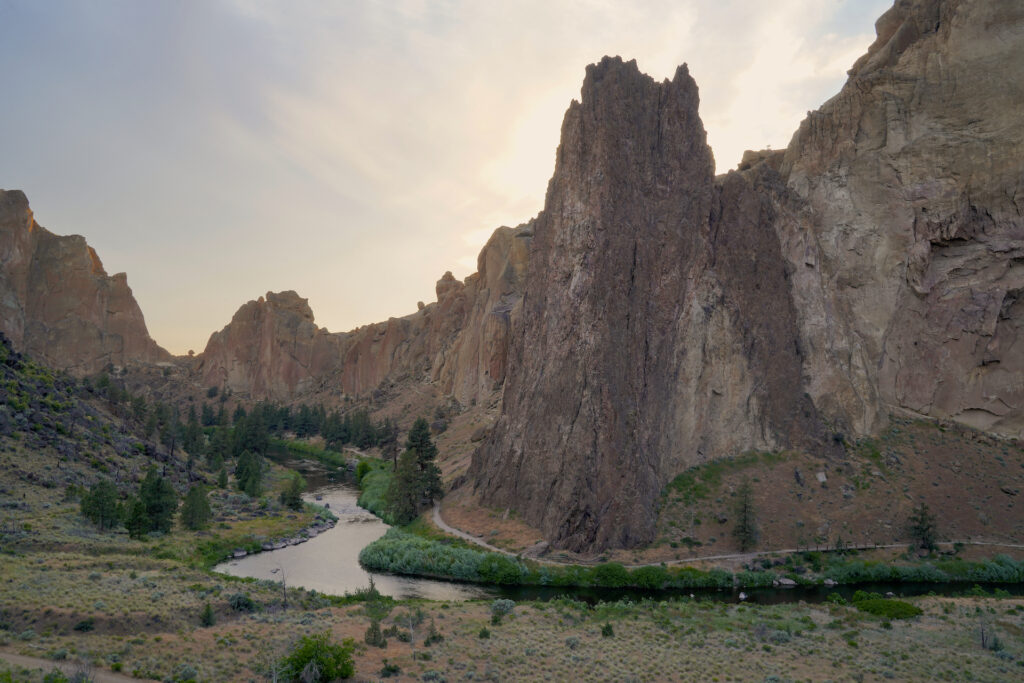
There are four parking areas for Smith Rock State Park, all found along the same access road. The first lot is for the walk-in camping bivouac area. Please park elsewhere if you are not camping. The second lot is the main oversize vehicle parking area. A pay station, overflow parking for smaller vehicles, and several trailheads are found here. The third and primary parking area is along the road. Flush toilets, a picnic area, a small welcome center, a native plant garden, the primary trailhead, and another pay station are all near the center of this parking area. Last, at the end of the road is the Homestead section of the park which has a small loop parking lot, a pay station, and yet more trailheads.
A lot of trailheads means a lot of trails! Honestly I haven’t done them all and even if I had trying to cover them all would be a chapter book, not a blog post. In addition to all of the main trails there are dozens of small spur trails which lead to various rock climbing routes…over 1,000 bolted routes scale the multitudes of faces, chutes, and crevices found on both sides of the river, with hundreds more routes for rope climbing and bouldering. Smith Rock is known as the birthplace of sport rockclimbing in the US for good reason! Well-known climbing areas include Morning Glory Wall, Rope-de-Dope, Asterisk Pass, Phoenix Buttress, Picnic Lunch Wall, Mesa Verde Wall, Monument, Southern Tip, Student Wall, Dihedrals, and many others. Several reputable local climbing guide services are available in the surrounding communities and can be contacted and reserved online.
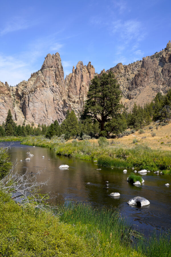
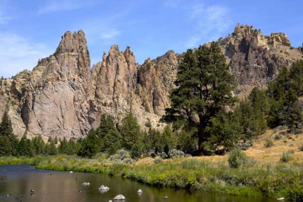
The big, lone tree across the Crooked River echoes the form of the craggy rocks behind it in Smith Rock State Park.
The Lone Wolf Tree – V
The big, lone tree across the Crooked River echoes the form of the craggy rocks behind it in Smith Rock State Park. To find out more about Smith Rock State Park: https://denphototravel.com/2024/smith-rock-state-park/
It’s difficult to even describe this park because it is so big and the main features are oddly shaped. From a straight down viewpoint the Crooked River flows from east to west through the park in the shape of a squished letter “S”, creating two side-by-side horseshoe bends with points of land sticking out alternate directions. The Smith Rock formation is on the overall north side of the river and parking is on the south side atop the flat basalt flow, which is about half the height of the taller Smith Rock formation. The park’s most popular trail is the Misery Ridge loop, which crosses the river and follows the west / downstream curve of the “S” along the easy River Trail, then shortcuts back to the trailhead by crossing over the top of the Smith Rock formation via a more difficult trail called Misery Ridge Trail.
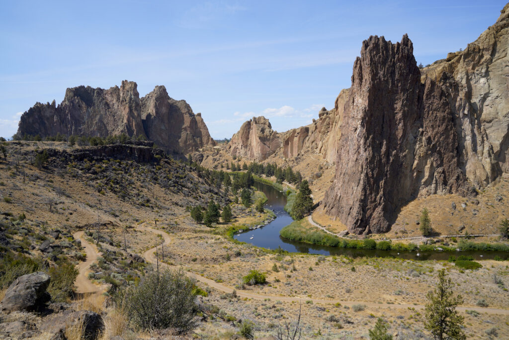
Here are a few other trails worth your time as well:
When I visited in August I went the opposite direction after crossing the main footbridge – east up the river canyon. This trail is called Wolf Tree Trail. It is easy, following the river through the desert woodland in the canyon bottom, with spectacular views of the Monument Rock section of Smith Rock and very few other people. Loved it!
North Point Trail and others with trailheads at Homestead, the last parking area in the park, are very easy as well and lead to some amazing views of the same overall area as Wolf Tree Trail. This area of the park was homesteaded by Otto Frank Wallenberg and wife Emily Stuart starting in 1909. The switchback trail from the this parking area to the canyon floor was constructed by them as a wagon road, and they built the canal that today forms the east edge of the park.
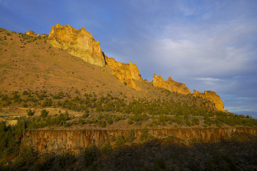
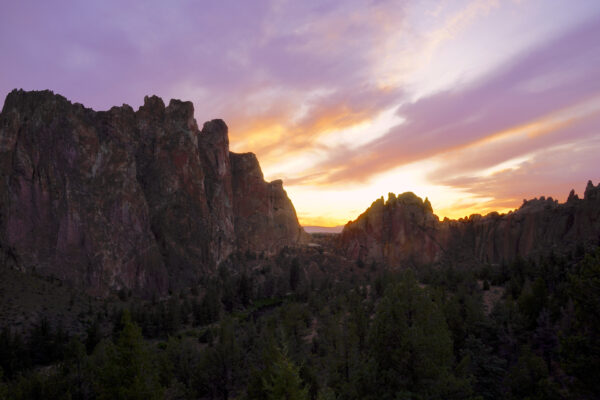
Rim Rock Trail, with trailheads leading from the overflow & large vehicle parking area, is very easy and is THE spot for sunset photos. Breathtaking!
If you’re into horseback riding, Smith Rock is fantastic, with designated routes including two ford locations across the Crooked River.
A few trails connect to other trails leading into BLM land or Forest Service land. Some of these trails connect across private land so please be respectful!
Overall the main trails in this park are quite easy. Avoid The Chute, especially on the way down into the canyon, if you’re concerned about slipping on the loose trail surface. Misery Ridge is honestly not as difficult as it sounds, and some of the trails that are marked easy do have short sections which are steeper. I absolutely love that Oregon State Parks added a few vault toilets along the main trails in the canyon bottom – for once they had the foresight to realize it’s too far to make it all the way back to the toilets at the parking areas. There is also a water fountain at the main lawn next to the footbridge in the canyon bottom. Smart placement, especially considering it can reach over 100F in summer.
I could not have asked for a better sunset than this one from my first ever visit to Smith Rock State Park. Rim Rock Trail certainly has the best sunset view in the park.
Smith Rock Sunset Splendor – Limited Edition
I had driven by Smith Rock State Park dozens of times on US-97, but had never actually been to the park until June 2024. I had planned a great itinerary for that day but spent far more time than I meant to enjoying nearby Cove Palisades State Park, arriving at Smith Rock just as the … Read more
In stock
Smith Rock State Park is a grand feather in the cap of the extensive Oregon State Parks system. With miles of trails to explore and world-class rock climbing set within a gorgeous desert canyon with unique geology harboring loads of wildlife and sublime views, this park has something to offer everyone who loves the great outdoors. The sheer size of the park ensures visitor’s ability to find some solitude here despite it’s well-deserved popularity. I have thus far visited twice, both times in summer 2024, and am already planning return visits during other seasons of the year. For me, Smith Rock ranks among the Seven Wonders of Oregon and is an absolute must when visiting the east side of the Cascades. Hats off to Oregon State Parks on this one, they knocked it out of the park!
Drones
Drones are only allowed August – mid-January to protect nesting raptors. Some climbing routes close during the no-fly period for the same reason.
Accessibility
The lack of handicap access to the majority of the park is the reason I do not give Smith Rock a 10. Better access is needed everywhere, including a more accessible design of the main park ammenities and an evenly-graded long ramp winding down to the main footbridge. From there many of the main trails, like River Trail and Wolf Tree Trail could be easily made accessible since they are already fairly flat and wide. Today the main park restrooms and the adjacent picnic area is all that is really friendly to folks with mobility issues. The immediate sidewalks at Homestead are accessible as well and the trail to the nearby viewpoint from there is flat.
Swimming
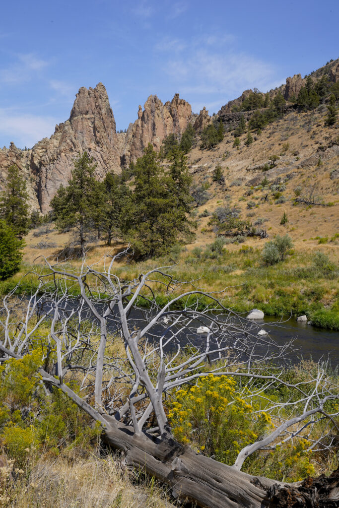
I’m a bit surprised that I didn’t see anyone swimming here as there are a few side trails that go down to the river’s edge and the current is not strong. While this park is not known for swimming I see no barriers to swimming here either.
Campground
The walk-in campground features first-come first-served tent sites at $8 per person per night. It’s about 600 feet from the parking area to the camping area. There are showers, potable water, and flush restrooms onsite. Campfires are prohibited. No RV camping or sleeping in vehicles is allowed. The campground is open in the warm season only.
A lone and stately pine tree towers above the rest along the Crooked River in Smith Rock State Park.
The Lone Wolf Tree – H
Smith Rock has miles of trails, too many to explore in one day. My housemate and I did a day trip to the park in August 2024 and decided to head up the Wolf Tree Trail instead of hiking the more popular River Trail / Misery Ridge Loop, which led us away from the crowds … Read more
Cautions
Beyond the obvious dangers associated with rock climbing, the biggest danger in Smith Rock State Park to the average visitor is the summer sun and the overheating, dehydration, and sunburn it can cause. The remedies are simple – be prepared for the exposed desert summer heat with appropriate gear, lots of water, and strong sunscreen. Winter conditions bring their own set of problems including hypothermia, frostbite, dehydration, and windburn. Slipping on the loose trail surface where the trail gets steep is the second biggest danger, one that can be addressed by wearing adequate footwear and by the addition of hiking poles. Falling off cliff edges at viewpoints is certainly a danger as well. In terms of wildlife dangers, rattlesnakes pose the greatest threat, followed by cougars.
Getting There
From Hwy 197 in Terrebonne, head east on Smith Rock Way for 1.6 miles, then turn left on NE 17th and continue for 1/2 mile. Turn right at the stop onto Lambert Rd / NE Wilcox Ave, then turn left in 1/2 mile onto Crooked River Rd, signed for Smith Rock State Park. The campground is about 3/4 mile down on the left, followed by oversize vehicle parking, main parking along the road, and finally Homestead.
Photographer’s Tip
There’s tons to photograph here…majestic rock formations, wildlife, the river, some really cool trees and plant life, people rock climbing…the list goes on. Morning is the time when the light shines on the majority of the rocks when seen from the main viewpoints and trails. In the late afternoon the light is on the far west side of the formation, accessed by following the River Trail around the rocks or by taking Misery Ridge Trail. Best spot for sunset is Rim Rock Trail, but honestly I imagine sunrise could be even better. I’ve seen gorgeous photography taken here in all seasons.
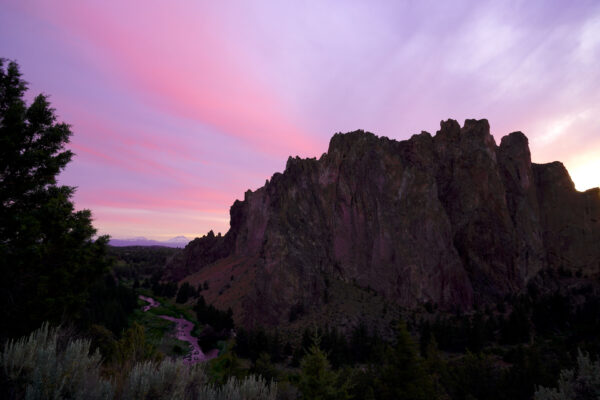
The afterglow of a glorious sunset paints the Crooked River an astounding shade of purple at the base of Smith Rock.
The Purple Vein
The soft, spreading colors of a glorious sunset paint the Crooked River an astounding shade of purple at the base of Smith Rock in June 2024. It was getting dark quickly but I was able to gather enough light using a 3.2-second long exposure to capture this incredible scene with Broken Top and South Sister … Read more
For More
I’m impressed at the amount of in-depth information about Smith Rock that’s available online. A few standouts are linked below.
Follow this link to the Oregon State Parks trail brochure for Smith Rock State Park, which gives a great deal more detail than I can provide here about the difficulty and distances of various trails. It shows the locations of various climbing areas but not the actual climbing routes.https://stateparks.oregon.gov/index.cfm?do=main.loadFile&load=_siteFiles%2Fpublications%2F%2FSmith_Rock_Trail_Map%28Web%29112059.pdf
There’s an entire website devoted to Smith Rock. This is a really well put together and beautiful website with loads of good information! https://www.smithrock.com/#intro
Smith Rock Master Plan is a guding document for the continued development and management of the park which was put together by Oregon State Parks and published in 2023. It’s well written and includes the most detailed information I’ve found so far about human history in the area. Plus it provides a glimpse into what changes are coming in the future. It’s a PDF document which will take a few moments to load. https://www.oregon.gov/oprd/PRP/Documents/2023_04_06_Smith_Rock_MP.pdf
Links
https://stateparks.oregon.gov/index.cfm?do=park.profile&parkId=36
https://www.oregonencyclopedia.org/articles/smith_rock_state_park
https://en.wikipedia.org/wiki/Smith_Rock_State_Park
https://traveloregon.com/things-to-do/destinations/parks-forests-wildlife-areas/smith-rock
https://www.overthepeaks.com/trip-reports/smith-rock-state-park
https://www.alltrails.com/parks/us/oregon/smith-rock-state-park
