Details
Region: Southern Oregon Coast
Location: US Hwy 101 between Gold Beach and Brookings, Curry County, Oregon
DEN Rating: 9/10
Trail Length: varies
Trail Type: varies
Hike Time: varies
Trail Difficulty: varies
Elevation Gain: varies
Trail Surface: varies
Popularity: 8/10
Family friendly: yes
Pet friendly: yes
Handicapped Accessible: varies
Swimming: no
Camping: no
Restroom: yes at some locations
Open Hours: day use (dawn to dusk)
Season: year-round
Pass or Permit: none required
Managed By: Oregon State Parks
Select photographs in this article are available as custom prints. Click on the shopping cart icon to see print media and sizing options. Click on the expand icon for a full-screen view of the image.
Samuel H Boardman State Scenic Corridor encompasses 12 miles of the beautiful Southern Oregon Coast along Hwy 101. Many consider this to be the single most beautiful and picturesque area of coastline in the continental United States. With over a dozen developed sites, miles of beaches, hidden coves, stunning rock formations, virgin forests, and breathtaking vistas, Boardman is well worth a full day (or more) of exploration.
Most visitors explore Boardman by driving between the various viewpoints, which is the easiest and fastest way to see the major features of this renowned area. Alternatively the 18-mile Boardman section of the Oregon Coast Trail gives access to many small hidden beaches plus all of the viewpoints, and can be hiked in several different segments.
This article covers each location in Boardman in north (Gold Beach end) to south (Brookings end) order, so if you’re traveling north on Hwy 101 you’ll hit the locations in reverse order. There is so much to see and do that it takes a very full day to see everything (I mean dawn to dusk during late spring and early summer when days are longest). Two or three days is more reasonable. My hope is to give you enough information that you can design your own itinerary based on the amount of time you have and the types of locations and experiences you’re looking for. When we visited in summer 2023 we stayed in Gold Beach the night before, spent the day driving south through Boardman, and spent the 2nd night in Brookings. We made it to most of the locations in Boardman in one day but not all and were exhausted by the end of the day. Links to each individual location are provided below each description, with links to Samuel H Boardman State Scenic Corridor as a whole at the end of the entire article.
Arch Rock
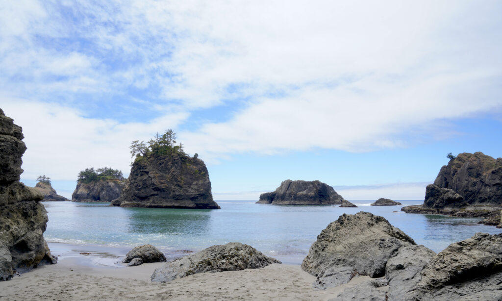
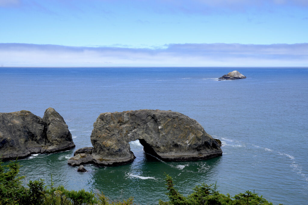
Arch Rock Viewpoint is the perfect start to a day in Boardman. A lovely view looking south along the rugged coastline greets visitors directly from the parking lot. An easy, paved, and fairly flat 0.3 mile loop trail leads through dark Sitka spruce forest on Windy Point to views of mighty Arch Rock and views looking north up the coastline. The meadow at the parking lot comes alive with wildflowers in spring and summer. Catch the Oregon Coast Trail at the south end of the parking lot to hike the coastline south – some nice views await! Vault toilets and picnic tables are available here. Everything except the Oregon Coast Trail is handicapped accessible. Arch Rock Viewpoint is a 10/10 for me, one of the must-see spots in Boardman.
The local Tolowa tribe legend tells that Arch Rock, a significant landmark for the tribe, was formed when Coyote was left to starve on Arch Rock after playing tricks on other animals and people. but Coyote, who embodies the spirit of enginuity, gathered a basket of mussels and tossed them into the sea. The mussels grew so big that they became the other sea stacks and small islands around Arch Rock, enabling Coyote to jump across back to shore.
https://www.alltrails.com/trail/us/oregon/samuel-boardman-scenic-corridor
https://www.outdoorproject.com/united-states/oregon/arch-rock-viewpoint-picnic-area
Spruce Island
Spruce Island is a massive block of stone rising from the Pacific covered in spruce forest. Unfortunately the roadside viewpoint has grown in with brush and the view is pretty much gone. Follow the moderately-difficult Oregon Coast Trail either direction to find views of Spruce Island – south to Deer Point from here offers especially scenic vistas. If you’re not planning on hiking it’s best just to skip this viewpoint.
Secret Beach
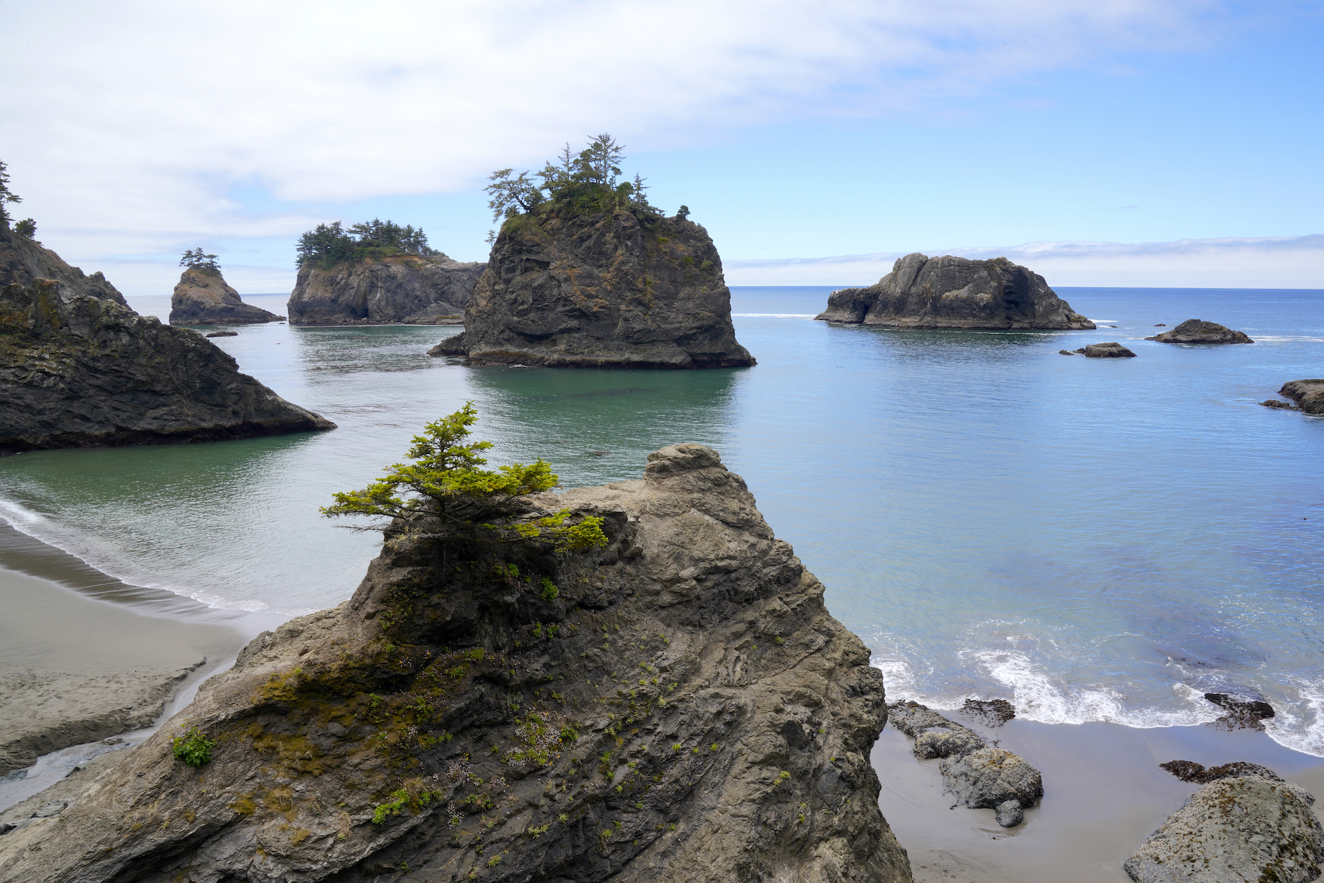
The only thing that makes Secret Beach actually secret in any way is that there is not a sign marking the parking area that most people use to access this absolutely stunning beach. It’s just gorgeous, so much so that it makes the Oregon 12 Most Photogenic Beaches list! Word has gotten out about this one, so don’t visit expecting an empty beach. It’s even labeled on Oregon State Parks maps and literature. It’s also known as Miner’s Beach, which is perhaps a more appropriate name since the secret is out!
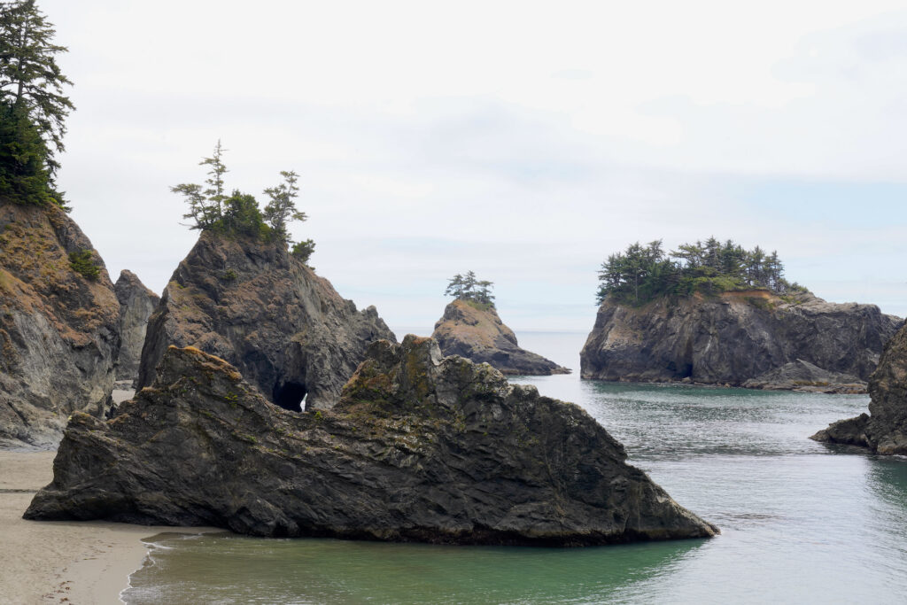
At Secret Beach you’ll find a gorgeous sandy beach backed by tall cliffs and gentle waves (by Oregon Coast standards) plus numerous tree-topped sea stacks and arches offshore. Miller Creek, at the north end of the beach, offers two waterfalls, including it’s lower falls dropping straight onto the beach. Miner’s Gulch has a really cool canyon carved out of the stone leading back from the middle of the beach. Slip along the rocks at low tide to the south end of the beach, with a hidden cove and tidepools (just be sure to not get trapped!) This is a decent spot for sea kayaking or even paddleboarding since the sea stacks break the waves up and shelter the beach. Secret Beach is another 10/10 Boardman location that is worth the effort!
Shore pines top the big monoliths at Secret Beach on a gorgeously still summer day. On a day like this the surf is flat enough for sea kayaking and even paddleboarding. Secret Beach may soon be renamed “Not-So-Secret Beach” because it is becoming quite popular. Getting onto the sand requires scrambling down the rock in the foreground and then climbing back up it.
Secret Beach
Large monoliths and sea stacks capped with hardy shore pines rise from calm seas at picturesque Secret Beach in Samuel H. Boardman State Scenic Corridor on the beautiful Southern Oregon Coast. For more on visiting Secret Beach: https://denphototravel.com/2024/samuel-h-boardman-state-scenic-corridor/ https://denphototravel.com/2024/twelve-most-photogenic-beaches-in-oregon/
The shortest way to access Secret Beach is from the unsigned parking area on the west side of Hwy 101, found at mile 345.3. It’s just north of a small bridge over Miller Creek. Look for cars in an unsigned parking area. The trail is short (about 1/4 mile) but fairly steep, passing Miller Creek Falls before ending on a rock overlook with the one of the best Oregon Coast views ever. Scramble down the rock to reach the sand. Expect the trail to be muddy and slippery in the wet season.
The other (but more official) way to access Secret Beach is by heading north along the Oregon Coast Trail from Thunder Rock Cove. This way is longer and is a little confusing due to the number of spur trails leading to other viewpoints. In general, follow the signs to “beach” if you’re using this route. It’s easy up until the drop down to the beach along Miner’s Creek, which is short but steep. The forest is beautiful along this hike and the ample viewpoints make is quite worth the time. Watch out for poison oak.
https://www.alltrails.com/trail/us/oregon/secret-beach-trail
Thunder Rock Cove
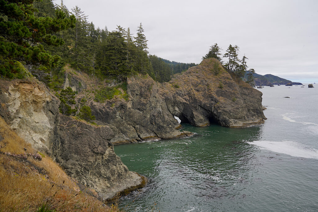
Yes! It’s such a cool spot! Take the short, easy hike out onto Thunder Rock for several incredible views. Every now and then you’ll hear the deep thunder of waves crashing inside a sea cave at the base of the cliff. You actually cross the top of a rock arch on this hike. A maze of little spur trails scatter here and there, and a beautiful clearing beneath the trees makes the perfect spot for a snack. Thunder Rock Cove just begs to be explored. Just be careful as many of the viewpoints have no guard rails. Watch for poison oak. My husband and I both loved Thunder Cove Rock, and my best friend Tyler, who makes at least one pilgrimage to Boardman per year, rates this as his favorite spot in Boardman as well. It’s magic, an absolute 10/10!
The main trail leads from the north end of the parking area, which has a decent viewpoint. Go left at the split to get on top of Thunder Rock. Going right at the split leads to additional viewpoints then eventually on to Secret Beach. The trail system actually works as a nice easy loop, with a few signs to point the way. The hike is surprisingly level, with only a slight drop in elevation down onto the rock – about 0.8 miles total to explore the rock. In addition, the Oregon Coast Trail heads south to Natural Bridges via some great views – it’s at the left end of the parking area.
https://www.outdoorproject.com/united-states/oregon/thunder-rock-cove
https://www.alltrails.com/explore/recording/thunder-rock-cove-hike
Natural Bridges
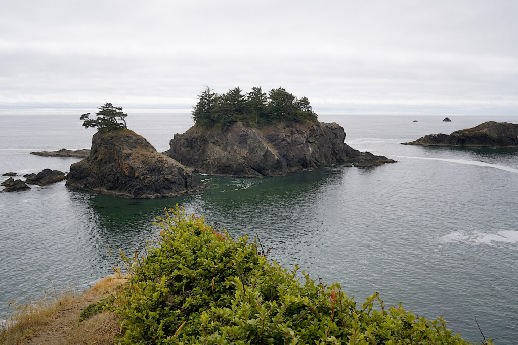
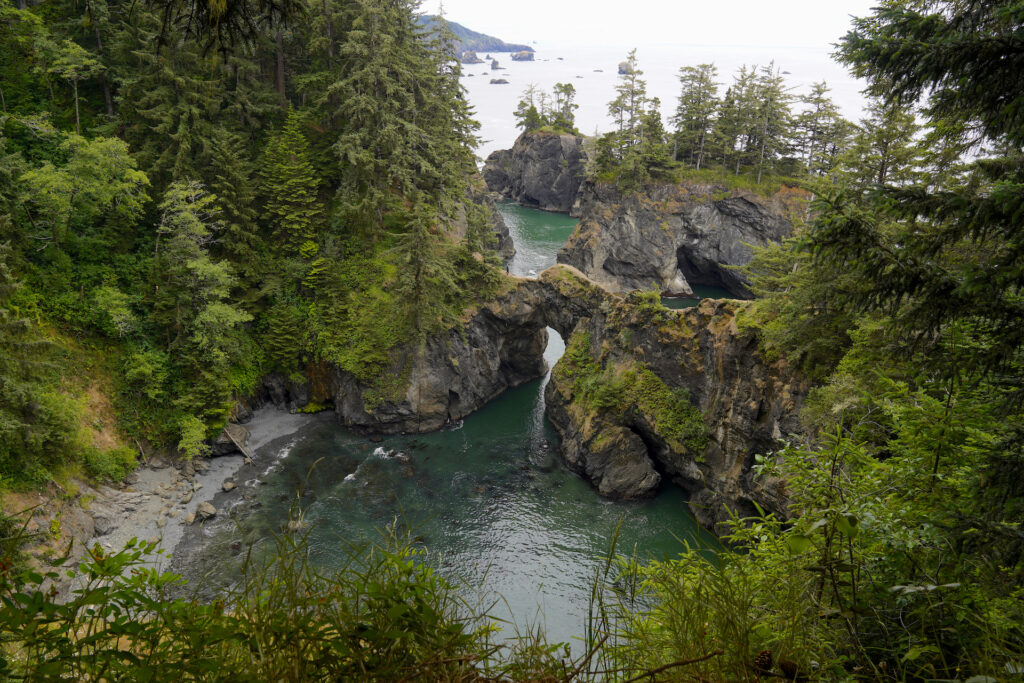
Seven rock arches reside here, making this perhaps the most popular and most photographed viewpoint in Samuel H Boardman State Scenic Corridor. The main viewpoint (paved, handicapped accessible) is found on the left/south end of parking area and is a tremendously picturesque spot! Continuing down the difficult trail from here leads out on top of the Natural Bridges formation. The trail that crosses the bridges is quite scrambly and exposed, with dropoffs on both sides plus very steep climbs on a thin, eroded path. It is often closed because it is quite dangerous.
The Oregon Coast Trail also continues south along the clifftop from here, with decent views. It’s pretty easy for the next 0.3 miles, with only 59 feet of elevation change.
Head north toward Thunder Rock Cove on the Oregon Coast Trail to find more viewpoints. The trail starts at the extreme right end of the parking area and appears to follow the road (it doesn’t). Within a few minutes you’ll come to a spur trail on the right with a big “Enter at your own risk” sign. This trail leads steeply down to the iconic south-facing view of Natural Bridges that you’ll find on a lot of travel blogs and Instagram sites. It’s a 7 out of 10 – fairly difficult but not awful. Continuing beyond this point is even more challenging, eventually leading down to and across the Natural Bridges formation via the very dangerous path described earlier.
https://www.alltrails.com/trail/us/oregon/natural-bridges-viewpoint-trail
https://thatoregonlife.com/2023/04/natural-bridges-oregon
North Island and China Beach
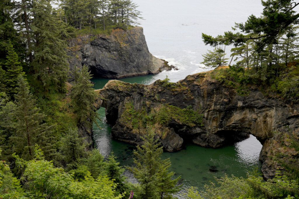
North Island provides the fastest access to lonely China Beach. I will be honest, I have not done this hike (few people have), but I will tell you what I know. China Beach is a wide, sandy beach backed by forested cliffs, with a lot of offshore rocks and sea stacks. Most other beaches in the area are much easier to access, so this one is normally pretty empty – as such it’s a great spot to look for seashells, agates, and other treasures. Reaching China Beach involves a 0.6 mile hike in which gets steep in the second half, and hiking back out means a 500-foot elevation gain. China Beach can also be reached by taking the Oregon Coast Trail south from Natural Bridges, but the hike is over twice as long and includes a steep area with exposed tree roots above the beach. Plan to spend at least two hours on a visit to China Beach from North Island, longer from Natural Bridges.
https://www.outdoorproject.com/united-states/oregon/china-beach
Thomas Creek Bridge
Thomas Creek Bridge is Oregon’s tallest highway bridge, spanning a deep canyon near the mouth of Thomas Creek. It’s a whopping 345 feet drop to the sand below! The viewpoint gives an unonbstructed side view of the bridge and the deep chasm it crosses. Another loop trail leads out around the headland to the south of the bridge – it’s 0.7 miles including all of the spur trails, some of which are not well-maintained. There are some alright views (along with some huge dropoffs) but mostly it’s just a walk through the coastal forest. This is one of the less popular stops in Boardman. Taking the Oregon Coast Trail south from here leads to another viewpoint looking down at an empty beach below. Drive past this stop if you’re short on time.
https://www.alltrails.com/trail/us/oregon/thomas-creek-bridge-overlook
Indian Sands
Starting at the south end of the parking area, follow the wide trail up a short, steep hill into the forest, then turn right to follow the Oregon Coast Trail to Indian Sands, where eroded sandstone cliffs have become a small dune complex perched high above the ocean. This is a fairly unique feature with great views, definitely worth exploring! A 1.1-mile moderately difficult (6 out of 10) loop can be achieved by crossing the dunes and picking up the trail at the far end, then bearing right at the trail junction to return to the parking area. Indian Sands in one of the more popular Boardman locations.
https://www.outdoorproject.com/united-states/oregon/indian-sands
https://www.alltrails.com/trail/us/oregon/indian-sands-trail
Whaleshead Beach
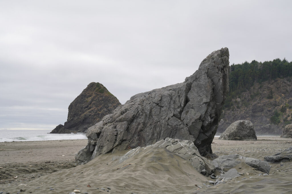
Whaleshead Beach is the longest beach in Samuel H. Boardman State Scenic Corridor. It can be accessed two ways, both of which have their challenges. Whaleshead Picnic Area offers both picnic tables and vault toilet restrooms plus an easy and short trail to the beach, but the road down to the parking area is a surprisingly rough gravel road that’s best suited for high-clearance and 4WD vehicles if conditions are wet or muddy at all. The second access is at Whaleshead Viewpoint, which offers a wide and clear view of the beach and offshore islands. The 0.2-mile trail down to the beach from here is steep, extremely narrow, and very eroded – a 6 out of 10 in difficulty with 190 feet of elevation gain on the way back up (and the trail is hard to find on the beach – make a little rock pile or marker of some kind).
Whaleshead Beach itself is a glorious beach! It’s decently long and features lots of cool, interestingly-shaped rock monoliths both on- and offshore. Whaleshead Island is the large conical formation off the north end of the beach. Because the road and trail are both challenging, this beach is usually pretty empty. When I visited I could only see one other group of people on the entire beach. The south end of the beach had no one on it at all.
https://www.oregonhikers.org/field_guide/Whaleshead_Viewpoint_Trailhead
https://www.brookingsharbororegon.com/whaleshead-beach
https://www.outdoorproject.com/united-states/oregon/whaleshead-beach
House Rock
This small fort-like viewpoint offers a gorgeous view looking north up the forested coastline, and features a memorial to Samuel H. Boardman, Oregon’s first State Parks Superintendent who envisioned protecting this beautiful stretch of coastline as a state park. Taking the moderate Oregon Coast Trail south from here leads to several small secluded beaches, then eventually to Cape Ferrelo in 2 miles. If you’re pressed for time this is a spot to skip. The viewpoint is not handicapped accessible due to a flight of stairs.
https://www.outdoorproject.com/united-states/oregon/house-rock-viewpoint
https://www.hikingproject.com/trail/7063064/cape-ferrelo-viewpoint
Cape Ferrelo
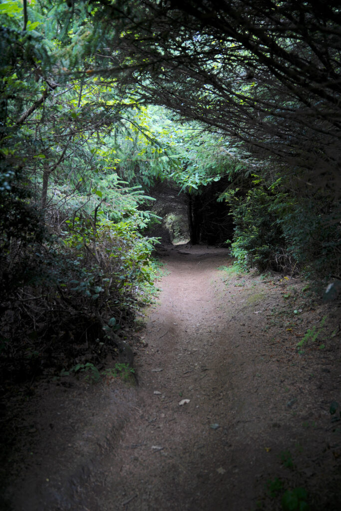
Named for a Spanish explorer who allegedly sailed past here in 1542, Cape Ferrelo offers surprisingly easy hiking to wildflower-filled meadows rolling down toward the sea and out to the tip of the cape. The hike can be done as a one-mile loop or out-and-back. The trail begins in open forest. Turn right at the first trail junction to head out to the cape (left leads to Lone Ranch Beach in 1/2 mile), passing through a very dark and cool tree tunnel through dense shore pines. Suddenly the forest gives way to grassy, windswept meadows. Go left at the split for an easy out-and-back with great views looking south, or go straightforward following the more moderate trail which bobs up and down as it heads to the tip of the cape before looping back around to the left trail. While everywhere else in Boardman is pretty densely forested, this hike provides a refreshing change of scenery, plus opportunities to see the spring and fall whale migrations and fantastic sunset views. In my opinion Cape Ferrelo is worth a stop! Remember not to pick the wildflowers!
https://www.alltrails.com/trail/us/oregon/house-rock-viewpoint-cape-ferrelo-trail
https://www.outdoorproject.com/united-states/oregon/cape-ferrelo-hike
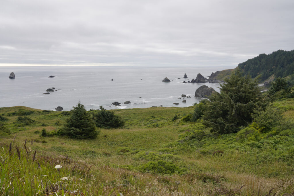
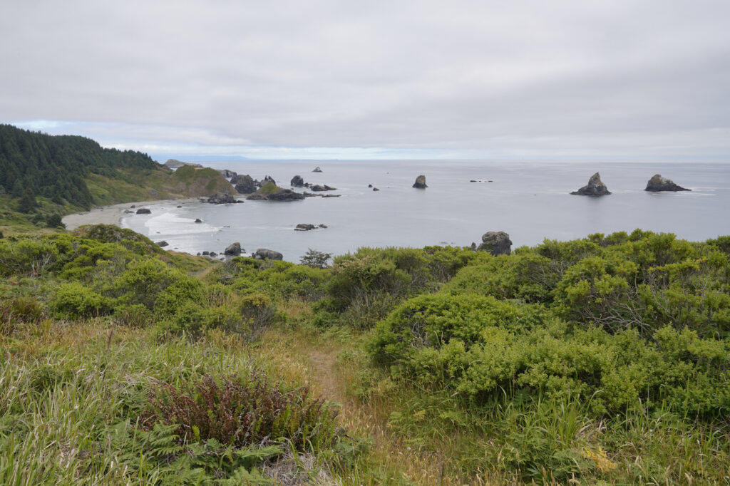
below: Coastal chaparral flourishes on Cape Ferrelo. This view looks south to Lone Ranch Beach.
Lone Ranch Beach
This is a wonderful family beach and a great spot to finish a day in Boardman! The crescent-shaped beach is very scenic and equally easy to access, with just a short paved trail down to the sand, plus vault toilets, picnic tables, and gorgeous views at the parking area – all ADA accessible. Tidepools hidden around the rocks and sea stacks offshore complete the ambience. Thiis is the most popular beach in the park due to it’s ease of access and close proximity to Brookings, but no so busy that it feels crowded. It’s well worth the time and a great spot for flying kites as well as taking in a glowing sunset.
https://www.brookingsharbororegon.com/lone-ranch-beach
https://www.outdoorproject.com/united-states/oregon/lone-ranch-beach-picnic-area
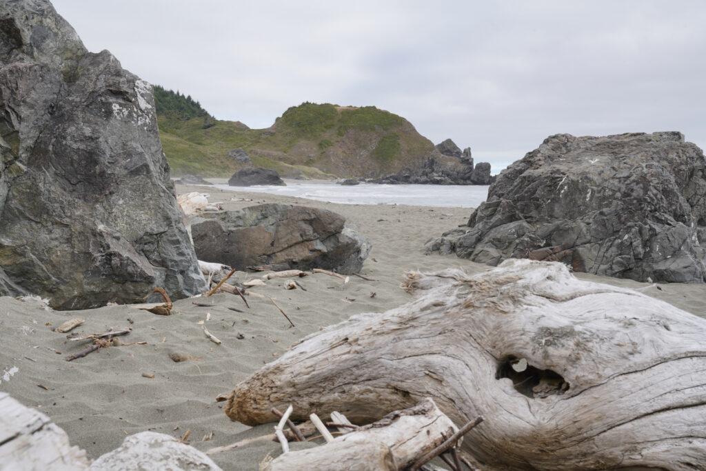
Samuel H. Boardman State Scenic Corridor offers a choose-your-own-adventure day of exploring the incomparable Southern Oregon coast. Within these twelve miles you are bound to find what you’re looking for to satisfy your coastal itch. If you’ve got the time, plan to spend 2-3 days to really explore the area thoroughly. Just remember to charge your camera battery and bring an extra memory card – beauty abounds around every corner in this rugged gem of the Oregon State Parks system!
Cautions
For the trails, the biggest danger is the huge drop down cliffs. Be especially careful at Natural Bridges, Thunder Cove, and Thomas Creek Bridge. Stay behind guard rails. Poison oak is around the area and present trailside at a few spots. Some of the less-visited trails can get obscure, overgrown, eroded, and steep in places. For the beaches, just exercise the normal cautions like watching for sneaker waves. Be aware that waves can shift driftwood. A few beaches get cut off at high tide so don’t get trapped. Also drive cautiously through Boardman – there are many turnoffs, small access roads, and roadside parking areas. Vehicles frequently enter and exit the winding highway. Fog is common which makes it harder to see vehicles turning off or pulling out.
Getting There
Samuel H Boardman State Scenic Corridor is sandwiched between Gold Beach and Brookings along Hwy 101. Some locations are directly on Hwy 101, others have longer driveways to parking areas. The various locations are mostly well-signed. Most have ample parking.
Photographer’s Tip
This is Oregon Coast photography heaven. A variety of lenses could be useful as well as a tripod and a CPL filter. Clouds and fog are common. September gives your best chance for clear conditions. Creeks and seasonal waterfalls are most robust in winter and early spring. The iconic Instagram view of Natural Bridges is found down the trail with the extreme “Enter at your own risk” sign, which is difficult but not horrible.
Links
https://stateparks.oregon.gov/index.cfm?do=park.profile&parkId=56
https://www.oregonhikers.org/field_guide/Samuel_Boardman:_North_Island_to_Arch_Rock_Hike
Tide Chart
https://www.tide-forecast.com/locations/Brookings-Chetco-Cove-Oregon/tides/latest

