Details
Region: Eastern Columbia Gorge
Location: 6500 Historic Columbia River Hwy, Mosier, Wasco County, Oregon 97040
DEN Rating: 9/10
Rowena Plateau Trail:
- Trail Length: 2 – 2.5 miles total (depending on route)
- Trail Type: partial loop
- Hike Time: 30-45 minutes for entire loop
- Trail Difficulty: easy 3/10
- Elevation Gain: 120 feet
- Trail Surface: dirt and rocks
McCall Point Trail:
- Trail Length: 3.4 miles total (4 miles total with trail extension)
- Trail Type: out and back
- Hike Time: 40-60 minutes to McCall Point
- Trail Difficulty: moderately difficult 6/10
- Elevation Gain: 1070 feet
- Trail Surface: gravel, dirt and rocks
Popularity: 8/10 (10/10 in spring)
Family friendly: yes
Pet friendly: yes at viewpoint, no on trails
Handicapped Accessible: yes at viewpoint, no on trails
Swimming: no
Camping: no
Restroom: none
Open Hours: day use only (dawn to dusk) on trails, viewpoint is open 24 hours.
Season: year-round at viewpoint, McCall Point Trail open May-Oct
Pass or Permit: none required
Managed By: Oregon State Parks and The Nature Conservancy
Rowena Crest Viewpoint is the star of the eastern Columbia Gorge, rivaling the epic views found at it’s western counterpart Crown Point, but far exceeding it in the wildflower department and in hiking opportunities as well. And everyone knows it. On spring weekends in April-May, when the balsamroot and lupine are blooming, Rowena Crest’s popularity rivals that of Multnomah Falls and parking becomes, at times, non-existent.
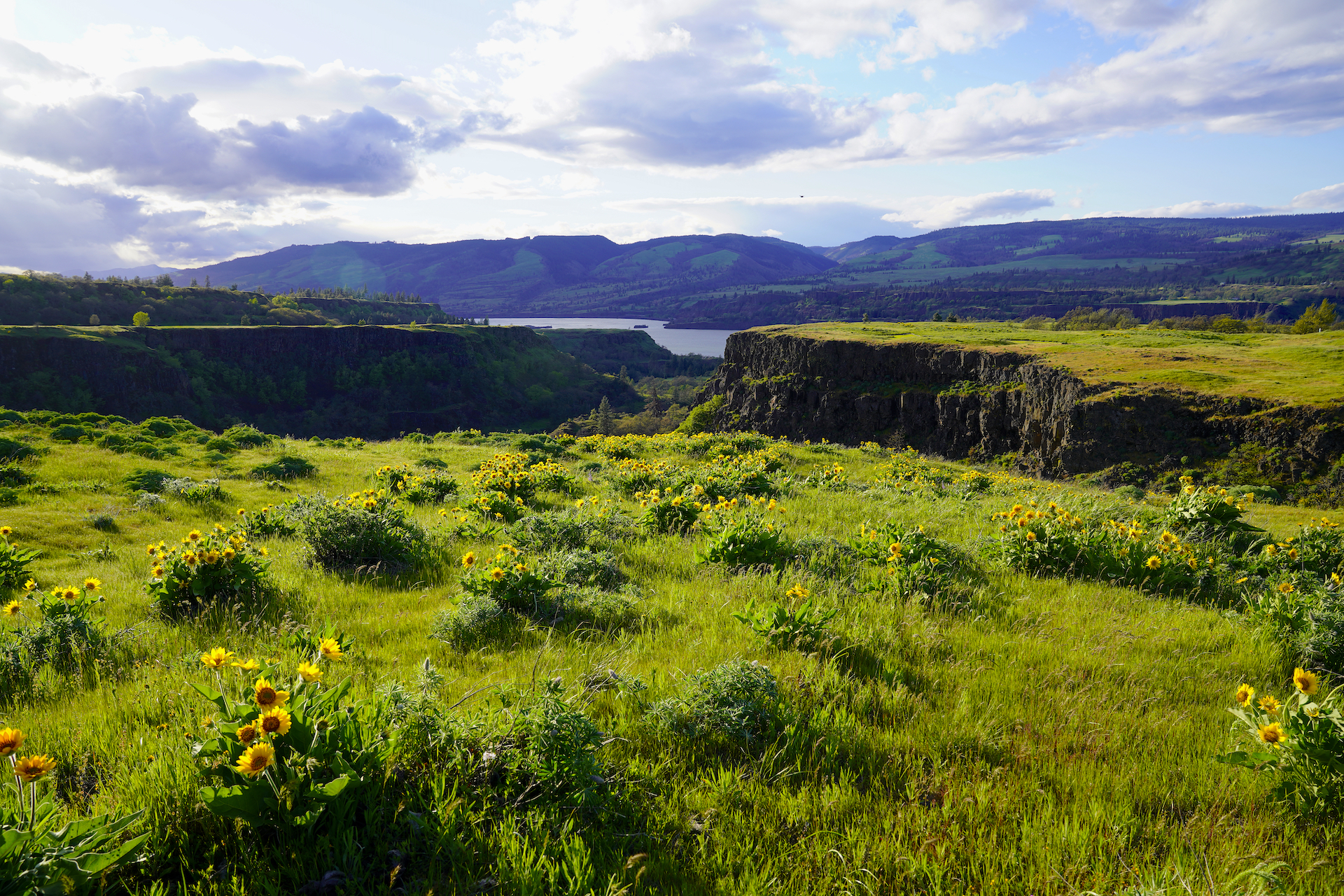
Balsamroot In Bloom
Clumps of yellow balsamroot flowers grace windy Rowena Plateau every May in the Columbia River Gorge east of Hood River, Oregon. To find out more about Rowena Crest: Rowena Crest Viewpoint https://denphototravel.com/2024/a-dozen-ways-to-celebrate-spring-in-oregons-willamette-valley/
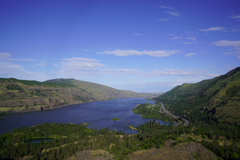
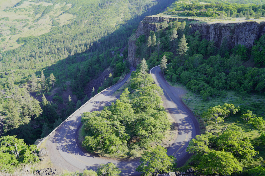
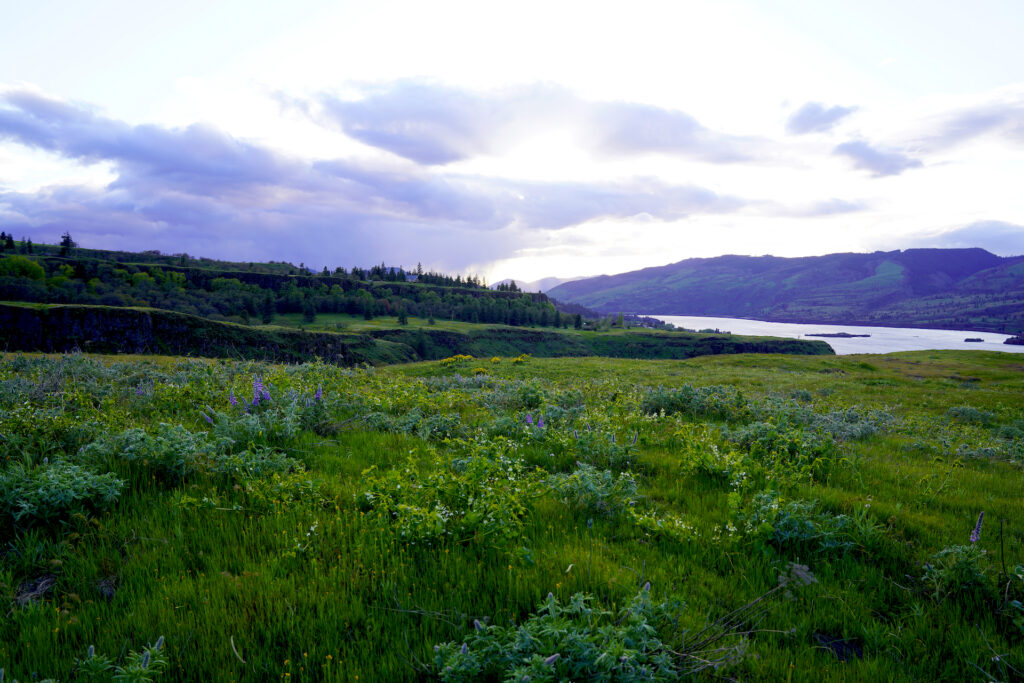
Rowena Crest Viewpoint is a joint venture between Oregon State Parks and The Nature Conservancy, which owns the Tom McCall Nature Preserve’s two units of land and their fabulous hiking trails to the south and west of the viewpoint itself. From the main viewpoint next to the parking area, visitors are treated with a brilliant panorama looking east up the Columbia River, plus an incredible view of the gracefully winding historic highway climbing up through the oak woodlands to the south. Just the viewpoint itself is worth a visit in any season and is an incredible spot to catch the sunrise, especially in June and July.
Rowena Plateau Trail
To the west of the parking area, across the historic highway, visitors can explore the windswept meadows of Rowena Plateau on the 2-mile Rowena Plateau loop trail. This area, part of Nature Conservancy’s Tom McCall Preserve, comes into incredible bloom every spring. The abundant wildflowers paired with the fantastic views of the cliffs of Dry Creek Canyon and the Columbia Gorge beyond it to the west make this one of the most popular spring hikes in Oregon. The trail is fairly easy, with spur trails looping out around a pond and along the gorge rim to the north where the view looks across the Columbia to Washington State. The view at the tip of the plateau looks west down the Columbia Gorge, but unfortunately the I-84 freeway becomes more apparent in the view near the end of the trail. Overall, especially in spring, this trail makes you feel like singing “The Hills Are Alive…!” Rowena Plateau is the epitome of a windswept view and is a magical place!
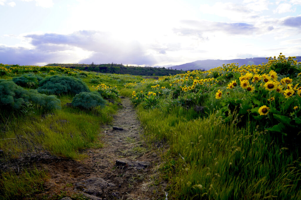
Dogs are not allowed on this trail or on the Nature Conservancy land. Please stay on the trail so that the beautiful and sensitive vegetation and soil is undisturbed. Trampling the flowers is not worth getting a picture of you or your family surrounded by flowers. There are plenty of spots on this trail where visitors can get family photos without killing the plants in the process. Also be aware that there is poison oak near the pond, including some right next to the main trail.
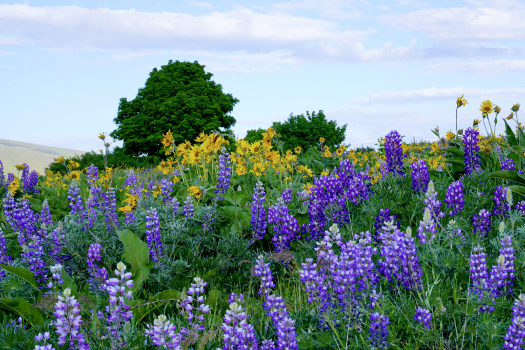
Tom McCall Point Trail
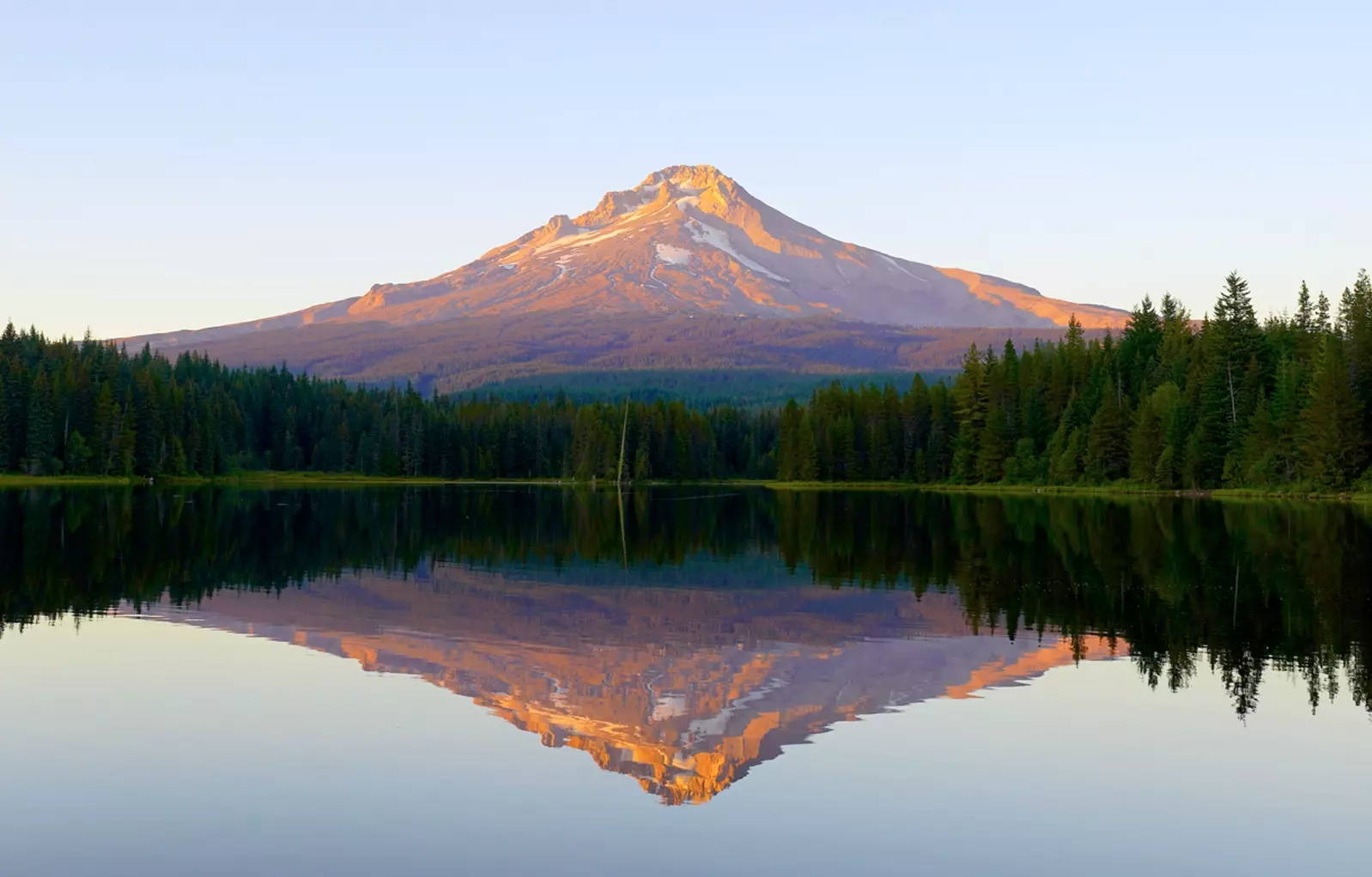
To the south of the parking area is the incredible McCall Point Trail, which ascends through flower-filled meadows and oak woodlands to a fantastic viewpoint with a great view of Mt. Hood. Of course this is not the only view – Mt Adams, Mt Defiance, and a few good views looking east up the Columbia Gorge all present themselves along this beautiful trail. This trail is longer and more challenging than the Rowena Plateau Trail but also offers a greater variety of habitats and less people (especially the further one heads up the trail). At about 1/4 mile up there is a boot path on the left that leads along the gorge rim with really great views. The sweeping view across the second meadow and then the beautiful trek up through the third meadow to the gorge viewpoint are highlights. Once at Tom McCall viewpoint, hikers can choose continue down a smaller and more difficult half-mile trail extension that dives into a gully and then climbs to a second peak with views sprinkled around the summit.
Beware of poison oak throughout the areas where oak trees are growing. Ticks are also a concern during the growing season so it’s best to wear long pants with the pant leg bottoms tucked into your socks. Dogs are not allowed on this trail.
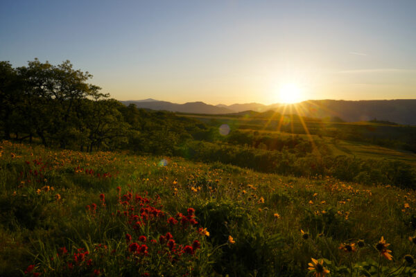
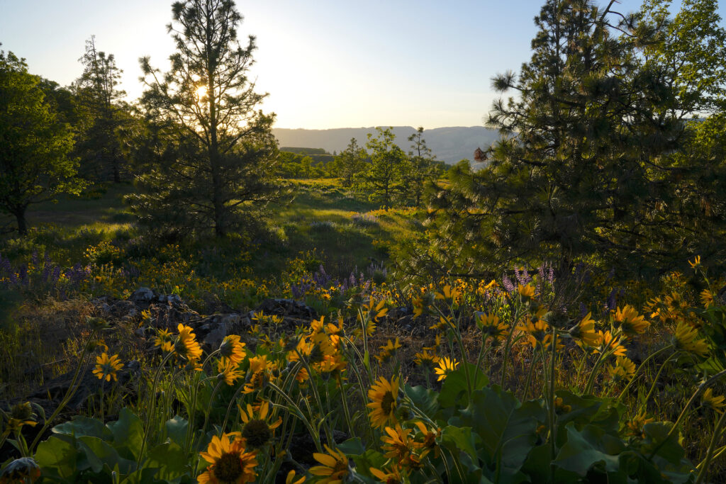
The last rays of sun spread golden light across a field of balsamroot and Indian Paintbrush flowers at Tom McCall preserve.
Tom McCall Sunset 1
The last rays of sun spread golden light across a field of Balsamroot and Indian Paintbrush flowers at Tom McCall Preserve at Rowena Crest in May 2024. To find out more about Rowena Crest: Rowena Crest Viewpoint https://denphototravel.com/2024/a-dozen-ways-to-celebrate-spring-in-oregons-willamette-valley/
I love how the color of the sunset rays match the golden tones of the balsamroot flowers as seen at Tom McCall Preserve.
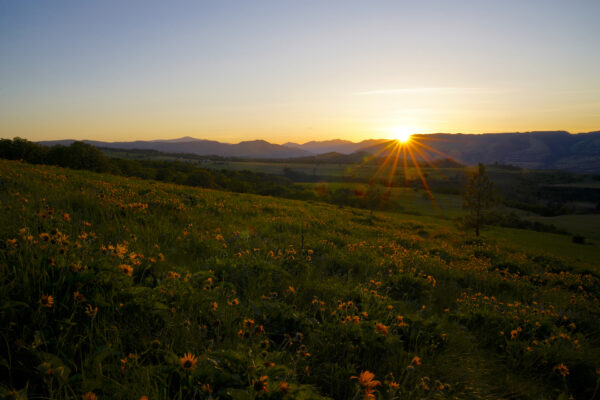
Tom McCall Sunset 2
The last rays of a golden sunset shine across a field of May wildflowers and prairie grasses at Tom McCall Preserve at Rowena Crest in the Columbia River Gorge east of Hood River, Oregon. To find out more about Rowena Crest: Rowena Crest Viewpoint https://denphototravel.com/2024/a-dozen-ways-to-celebrate-spring-in-oregons-willamette-valley/
Cautions
Falling either from the main viewpoint or off trails where they are near clifftops is the biggest concern, one that is easily remedied by just staying on the trails and behind the viewpoint railing. Poison oak is prolific in the eastern Columbia Gorge and is definitely present on both trails, more so on the McCall Point Trail – you’ll find it wherever there is brush near or beneath oak trees. This is rattlesnake and tick country, which are both more of a worry on the McCall Point Trail the further along you go. Wear long pants and a long sleeve shirt to protect from ticks. Overall the main Rowena Plateau trail is very safe and is perfect for families with youngsters (ticks are not as big of a concern on this trail). When the weather is sunny there is little to no shade here so bring lots of water, wear sunscreen, and maybe consider a parasol if its not windy. In the wet season, particularly winter and spring, the wind can absolutely howl here and windchill can become an issue quickly. A windbreaker jacket, gloves, and other protective clothing are anywhere from a good idea to absolutely necessary depending on the current conditions.
People can damage and destroy this gorgeous land. Please stay on the trail! Pack out your trash and please just look at the flowers instead of picking them – this includes kids! Also remember to use the restroom before coming to Rowena Crest Viewpoint as there is no bathroom or even a portable toilet here.
Getting There
Rowena Crest Viewpoint is found right along the eastern section of the Historic Columbia River Highway between Mosier to the west and Rowena to the east. Exit I-84 at either town and follow the main road up to the viewpoint, which is a few miles from either exit. The drives both directions are beautiful, but the Rowena loops to the east of the viewpoint are especially scenic and incredibly fun to drive!
Photographer’s Tip
You’ve hit photographer’s paradise! Incredible views are everywhere, with excellent sunrise and sunset photo opportunities coming to a peak around the summer solstice when the sun position is furthest down the gorge. This area is also wonderful for wildflower macro photos and offers lots of chances to photograph soaring bald eagles and turkey vultures, deer, rabbits, and other woodland critters. If you’re into light painting, the streaks of head and tail lights coming up the Rowena loops at night turn out perfectly. I personally would head further away from civilization for star photography as the town of Lyle, Washington is right across the gorge from here.
Links
https://stateparks.oregon.gov/index.cfm?do=park.profile&parkId=221
https://www.oregonhikers.org/field_guide/Rowena_Crest_Trailhead
https://www.oregonhikers.org/field_guide/Rowena_Plateau_Hike
https://www.oregonhikers.org/field_guide/McCall_Point_Hike
https://www.alltrails.com/trail/us/oregon/rowena-plateau-trail

