Details
Region: Northern Oregon Coast
Location: 1675 Peter Iredale Rd, Hammond, OR 97121
DEN Rating: 9/10
Trail Length: multiple trails; distances vary
Trail Type: out and back, loop, and through hikes available
Hike Time: varies
Trail Difficulty: easy 1-3/10
Elevation Gain: 50 feet or less
Trail Surface: paved, gravel and dirt
Popularity: 7/10
Family friendly: yes
Pet friendly: yes
Handicapped Accessible: yes at most locations
Swimming: yes
Camping: yes
Restroom: flush and vault toilets
Open Hours: day use only (6AM to 10pm, campground 24 hours)
Season: year-round
Pass or Permit: $5 day use areas, other areas free
Managed By: Oregon State Parks
Select photographs in this article are available as custom prints. Click on the shopping cart icon to see print media and sizing options. Click on the expand icon for a full-screen view of the image.
Fort Stevens State Parks occupies the extreme northwest corner of Oregon, where the mighty Columbia River finally empties in the Pacific Ocean. This sprawling 4,300-acre park includes miles of beaches, gorgeous coastal forests, a huge river bay, and two lakes. But unlike most Oregon State Parks, the history of humans at this location is the star of the show. From the site of an indigenous Clatsop longhouse to historic military installations and the recent Columbia River South Jetty, visitors can explore the varied remains of human activity at this important location.
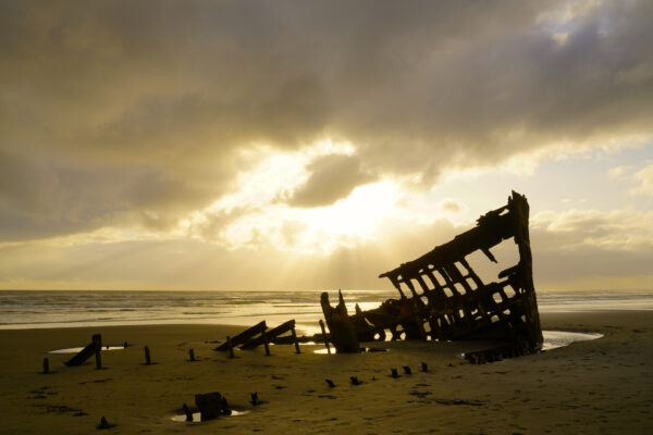
Beams of light shoot through the clouds at the 1905 wreck of Peter Iredale at Fort Stevens State Park near Astoria, Oregon.
Reaching For The Light
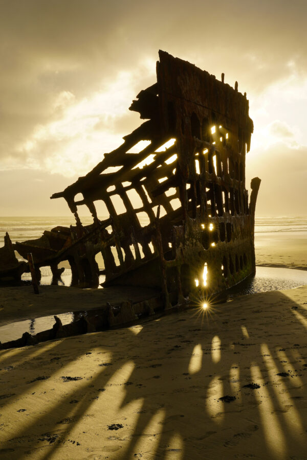
Winter storms in early 2023 had washed a few feet of sand away from the 1905 shipwreck of Peter Iredale on the beach at Fort Stevens State Park near Astoria, Oregon, exposing the size of the wreck and shape of the hull. I lucked out with an astounding sky the day I took this photo. I … Read more
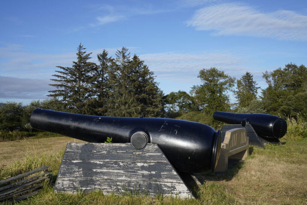
The most striking evidence of human use of this area is the many batteries and bunkers that made up historic Fort Stevens, an important military base which operated here from the time of the Civil War until the end of WWII. One of the batteries was even attacked by Japanese submarines in 1944. Several batteries remain, plus the concrete ruins of other military buildings and the foundations of what appears to have been an extensive concentration of barracks and houses for officers. Replica cannons and large guns dot the historic fort areas. Some of the chambers within the batteries can be explored, but others are closed off. Most of what is standing seems to be in fairly good shape still so exploring doesn’t feel sketchy. I think what impressed me the most is that none of it is covered in graffiti, there was no visible trash around, etc…clearly the state park is doing a nice job at preserving this historic site. A small free museum is located centrally in the park’s historic area fosucing on the military history found here. The Historic Area is one of the two sections of the park where a $5 day use (parking) fee is charged. Exploring the Historic Area fully takes 1-2 hours. There is also a disc golf course adjacent to the Historic Area.
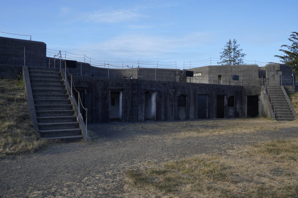
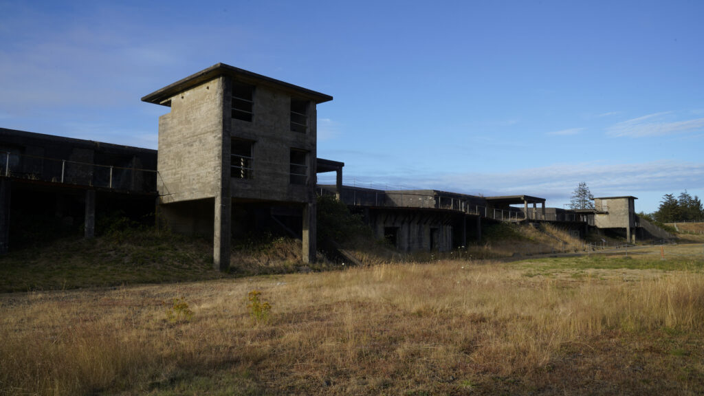
There is a second large battery outside of the paid historic section as well. Free parking here!
Battery Russell sits at the top of a large earthworks and looks like a cool, somewhat creepy old industrial complex. This one is really fun to explore. If you’re at all pressed for time or short on funds then my advice is to skip the Historic Area and just visit Battery Russell. A flashlight could come in handy in some of the deeper hallways and darker rooms in this complex.
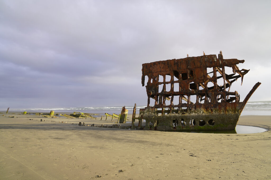
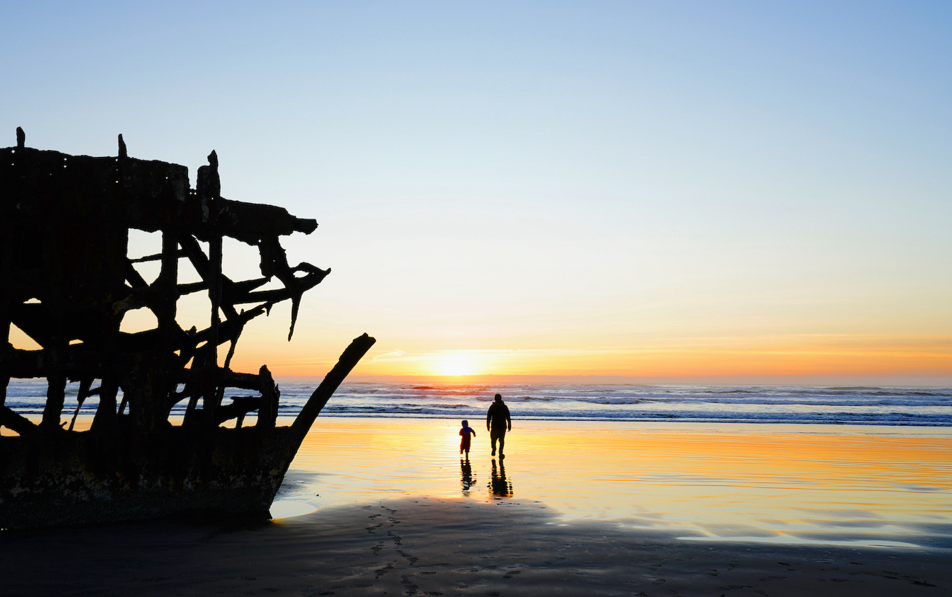
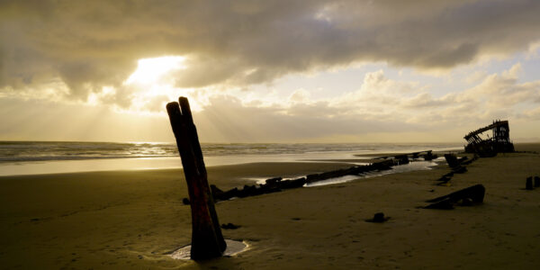
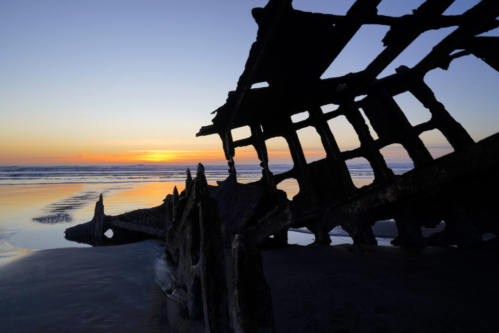
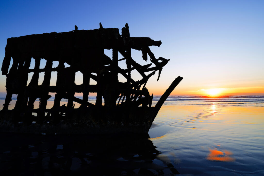
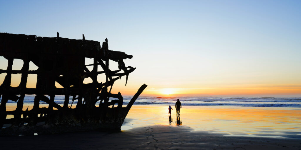
The park’s big draw, however, is not the fort ruins; it’s the wreck of the Peter Iredale, Oregon’s most famous shipwreck, which has been rusting and rotting on the beach here since 1905. Today very little of it remains, but the iron bow of the ship is still intact. Depending on the year, winter storms either pile up sand over the rest of the wreck or pull it back to reveal the remnants of the hull’s ribs and a few metal poles that were once part of the stern. If you’ve ever wanted to see an old shipwreck, this one is free, easy to access, and is really cool to walk inside of. If you want to learn more about the Peter Iredale, check out the exhibit inside the nearby Columbia River Maritime Museum.
The iron framework of the bow of Peter Iredale is all that remains from this 1905 shipwreck. I was at Astoria Column which has a phenomenal view, and the sky was doing some cool stuff so I headed to Fort Stevens in hopes of good sunset color. About half an hour after getting there the light shifted from silver to platinum to golden, lasting for about twenty minutes before disappearing behind thick offshore fog and gathering clouds.
In The Shadow Of What Was
The wreck of Peter Iredale at Fort Stevens State Park near Astoria is such an exquisitely tangible slice of Oregon history in a place where, compared to most of the world, very little has happened that people remember or that there is any physical evidence of. I’ve been here around sunset several times, but this afternoon … Read more
The shipwreck is at the southernmost of four beach parking areas in the park. The beach itself is tremendously long, stretching all the way from Gearhart (ten miles south of the park) to the park’s South Jetty. Almost all of the beach visitors head to the beach access next to Peter Iredale, so head to one of the other beach accesses to the north if you’re looking for a wide slice of beach all to yourself. The only beach access points with restrooms are at the shipwreck and at South Jetty. Vehicles are allowed to drive on the beach starting all the way down in Gearhart up to the shipwreck, but are prohibited from Peter Iredale to South Jetty between noon-midnight May 1st – Sept 15, which helps keep the northern beach areas in the park all the quieter.
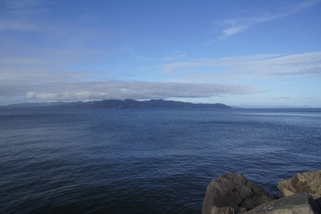
If you park at South Jetty you’ll have to walk down the jetty for about 500 feet (it’s basically a gravel road) to reach the beach, but the view looking down the coast from the jetty is exceptionally good and definitely worth the few minutes walk. The jetty itself is undergoing a huge repair and construction project through 2024, so walking out to the end of the jetty and seeing the famous Columbia Bar Crossing (notorious for sinking ships) is not currently possible. All of the beach parking areas are free. The jetty is not handicapped accessible.
Historically the South Jetty, built on the tip of Point Adams, has been a signficant point for centuries. Fort Stevens is actually part of the Lewis and Clark National Historic Trail and National Historic Park because the Lewis and Clark party visited Point Adams during their famous expedition in 1803. The Columbia River is the largest river to enter the Pacific Ocean in all of North America, making the point where the river and ocean meet especially important for fishing, maritime navigation, and trade. The Columbia Bar crossing, with it’s swirling and unpredictable currents, has claimed over one hundred ships and the lives of dozens of sailors over the past 200 years. The jetty has helped to tame the currents a bit.
At the far end of the main road, past the South Jetty, is another area of the park on a point that sticks out into the Columbia River. Here visitors can explore a small area of grassy dunes and a beach on the freshwater Columbia River’s Trestle Bay (so named because a train trestle used to cross the bay – the line of cement pilings are still visible). A few different trails lead out from the far end of the parking area near the vault toilet to Columbia Beach and form a small network through the sand and tall grass. Swimming would be much safer (and warmer) at this beach than at any of the Pacific Ocean beach accesses. A wildlife viewing bunker help birdwatchers look for waterfowl in the bay when the weather is nasty. And speaking of wildlife, elk and deer are both very common throughout the park and surrounding area, so keep an eye out and slow down in the early morning and evening when these animals are most active.
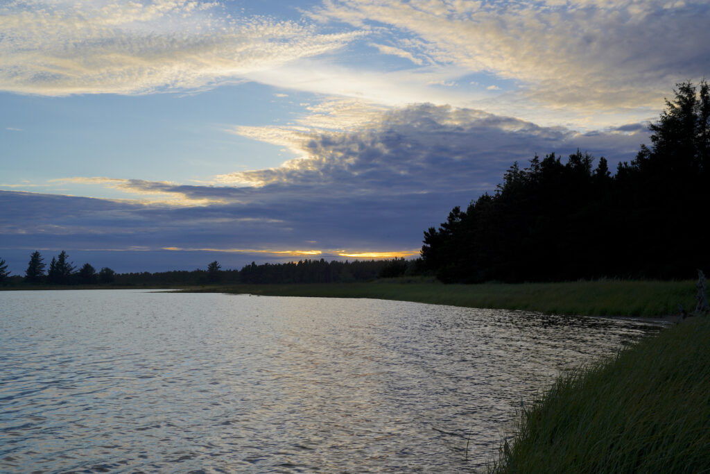
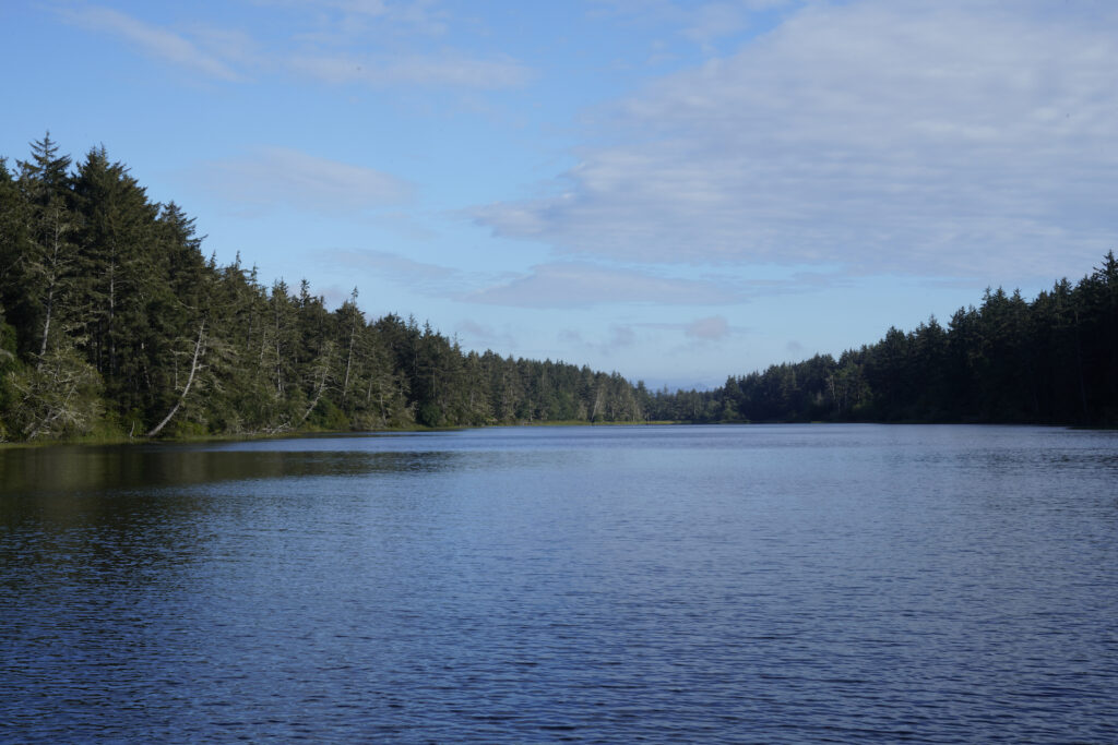
Perhaps you’re just seeking a quiet place to enjoy the beautiful forest, or somewhere to take a peaceful walk away from the roar of the ocean and the buzz of traffic. Coffenbury Lake is the answer – a mile-long sliver of lake surrounded by hemlocks, Sitka spruce, and shore pines. A two-mile trail encircles the lake with many views of the water. The lake is the other part of the park with a $5 day use parking fee. Two day use areas (North and South) provide parking, trail access, picnic shelters, and flush toilets. North day use area has a small boat ramp and dock, as well as a big swimming area. I have to say I was surprised that the water actually warms up into the low 70’s in the summer – certainly not the shocking cold I was expecting from coastal water. The lake at the swimming area is shallow for a long ways out. Unfortunately the water is a dull brown-green with poor visibility. Oregon State Parks also offers kayak tours of the lake.
The park’s sprawling campground takes up a big portion of Fort Stevens State Park and is actually one of the largest public campgrounds in the United States. It is clearly a very popular campground, offering everything from simple tent sites to RV sites with hookups to yurts to deluxe pet-friendly cabins. Camping is by reservation only.
Fort Stevens is a huge park, so it has three different entrances, all found off Ridge Rd in Hammond. The northernmost entrance leads to the Historic Area ($5 day use parking fee). The middle entrance is the Day Use entrance, while the south entrance goes directly to the campground. Roads connect in the park between the middle and south entrances.
The trail network through the park is immense, with paved multi-use paths connecting all parts of the park except the north end (South Jetty and Columbia Beach). The ranger station, at the south / campground entrance, has free maps of the park which show the various paths. Almost all of these paths are paved and multi-use (shared with bicycles). This is great area for walking or jogging because the paths are wide and mostly flat. Almost all of the paths and trails in the park are handicapped accessible, as are all of the restrooms.
I like Fort Stevens State Park because it offers historic places to explore that you really can’t find anywhere else in Oregon. The shipwreck and the fort are both unique sights that you can actually get inside of, climb on, and otherwise adventure through. The fort is quite extensive, and the shipwreck is perfectly placed for photography, especially at sunset. Beyond the human aspects of Fort Stevens, the park has a lot to offer nature lovers. The flat terrain makes walking or biking fun and easy. For families this park is an ace. There’s something for everyone at Fort Stevens State Park!
Cautions
The cold and powerful Pacific Ocean is the biggest danger here – be aware of sneaker waves, rip currents, and logs in the surf. Do not try to swim in the ocean. The lake swimming area and Columbia Beach are both far more safe and the water is significantly warmer. Stay out of closed / chained / roped off areas at the military sites and at South Jetty. Parts of the park can get busy, so drivers, bicyclists, and pedestrians all need to watch out for each other particularly at the few points where trails and roads intersect. Drivers need to also watch for and slow down for elk and deer. In the winter the combination of wet, cold, and wind can be dangerous so head for shelter if you’re getting cold, feeling weak or disoriented, etc.
Swimming Hole Info
Coffenbury Lake is the main swimming area at Fort Stevens State Park. This is a perfect spot for families with younger kids. Columbia Beach offers another swimming opportunity, but also one with possible current and potential pollution.
- summer water temp: cool 65F-73F
- water clarity: 0-3ft
- color: brownish green
- Depth: 20-40 feet with a big shallow area
- Current: 0 (none)
- Shoreline & stream bottom surface: sand, muddy / slimy in spots
Getting There
Several signs direct visitors to the park from US-101, which is found west of Astoria / Warrenton and north of Seaside / Cannon Beach.
From Astoria (points north & east): Take US-30 Westbound to US-101 Southbound. Turn right onto E Harbor Dr and follow for 1.3 miles, then turn left onto N Main Ave and continue for a little over half a mile through Warrenton. Turn right onto S 9th Ave and continue for 1 mile, then turn left onto Ridge Rd. You’ll come to the south park entrance in slightly under 2 miles, with the other park entrances slightly further up the road.
From Seaside (points south): Head north of US-101, then turn left onto Hwy 104 (about ten miles north of Seaside). Turn left again in 0.4 miles onto Columbia Beach Rd, which becomes Ridge Rd. You’ll come to the south park entrance in 3 miles, with the middle and north entrances a little further up the road.
Beams of light shoot through the gathering clouds above the wreck of Peter Iredale on Fort Stevens Beach.
The Wreck – Limited Edition
Visiting the 1905 Peter Iredale shipwreck is always the highlight when I visit Fort Stevens State Park, especially for sunset. This visit in May 2023 turned out to be singularly magnificent. The afternoon had been filled with a lot of sun rays poking through the clouds, and I was hoping the display would continue as … Read more
In stock
Photographer’s Tip
Peter Iredale is by far the most photographed subject in the park. It’s positioned perfectly for a sunset silhouette. The decommissioned / ruined military installations offer a completely different photographic environment. Overall Fort Stevens a huge park with so many different sections to it that you’ll likely find something that’s up your alley. The Columbia Beach / Trestle Bay area is quieter with lots of opportunities for photographing wildlife, and the park has pretty forest areas which the trails and paths snake through (think foggy forest, hopefully with a beam of light coming through.) Coffenbury Lake is another area with a high potential for wildlife. Most of the park’s vegetation is evergreen so don’t expect a big show of fall color leaves here.
Links
https://stateparks.oregon.gov/index.cfm?do=park.profile&parkId=129
https://www.nps.gov/places/fort-stevens-state-park.htm
https://oregon.com/attractions/fort-stevens-state-park#google_vignette
https://www.alltrails.com/parks/us/oregon/fort-stevens-state-park
https://www.oregonhikers.org/field_guide/Fort_Stevens_Loop_Hike

