Details
Region: Columbia Gorge
Location: Historic Columbia River Highway at the Bridal Veil exit off I-84.
DEN Rating: 6/10
Trail Length: 4.6 miles total (2.3 to Angel’s Rest summit)
Trail Type: out and back, can be combined with Wahkeena Falls / Fairy Falls hike
Hike Time: 1:20 to 1:45 each way
Trail Difficulty: difficult 7/10
Elevation Gain: 1,489 feet
Trail Surface: dirt, rocky sections
Popularity: 7/10
Family friendly: no
Pet friendly: yes
Handicapped Accessible: no
Swimming: no
Camping: no
Restroom: none
Open Hours: day use only (dawn to dusk)
Season: year-round
Pass or Permit: none required
Managed By: Oregon State Parks and US Forest Service
Select photographs in this article are available as custom prints. Click on the shopping cart icon to see print media and sizing options. Click on the expand icon for a full-screen view of the image.
Angel’s Rest is rocky promontory overlooking the Columbia Gorge near Portland, OR. The Ange’s Rest hike is an Oregon classic, featuring a variety of ecosystems and some stunning views at the end of the trail. However, Angel’s Rest hike is fairly long with a big elevation gain, making it not suitable for everyone. Most of the area is part of the Shepperd’s Dell State Natural Area and is managed by Oregon State Parks along with US Forest Service.
In my mind this hike has four distinct sections (AllTrails describes it as three). It begins with a journey along the side of the Columbia Gorge, climbing gentry through the old-growth forest, then more moderately across a few very rocky talus slopes. This section ends where a spur loop trail leads off to the right for partial views of Coopey Falls, one of the lesser-known Columbia Gorge waterfalls. Be careful around the viewpoint area as the ciffs drop straight down over 100 feet. There is also a cool rock point but it lacks good views. You’ll hear the sounds of a second waterfall south in the forest (the lowest tier of Upper Coopey Falls), and there is a steep spur trail leading that way, but don’t follow it – a huge log has fallen in the creekbed and the brush is very thick so there’s no way to get a view of the falls you hear.
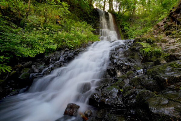
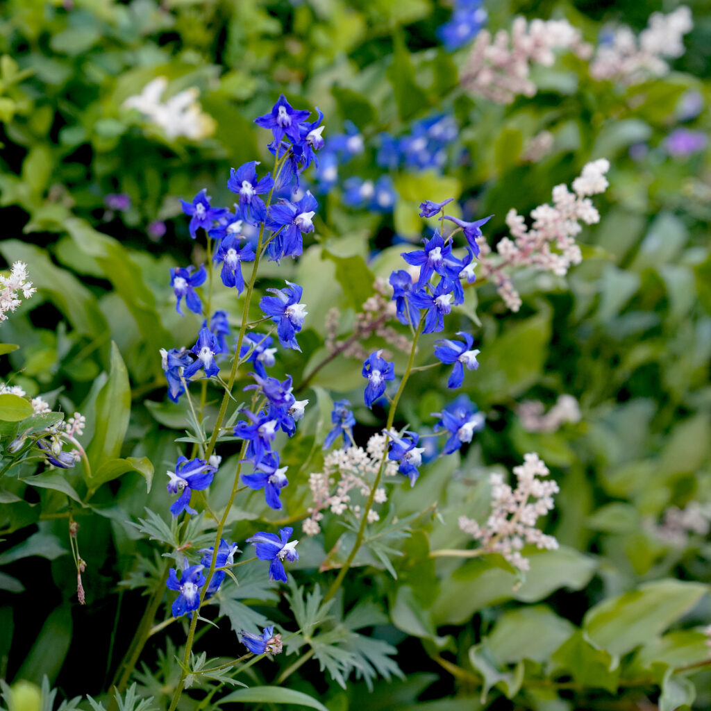
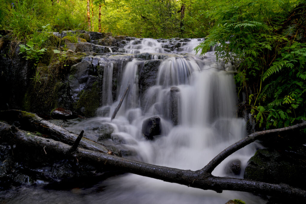
The second section follows the creek back past Upper Coopey Falls (you’ll get a partial view of the taller second tier from the trail, then a better view of the small uppermost tier), then crosses the creek on a bridge with a nice setting, then switches back several times beneath the trees as it climbs out of the creek canyon. In late spring/early summer there is a ton of blue larkspur blooming along the trail in the patches where there are gaps in the tree canopy. What a pretty surprise! Upper Coopey Falls is real hidden gem that it worth a visit. What a great spot to relax and enjoy a lunch or a hiking break! To reach the falls base and really see the falls, head back downhill about 80 feet from the partial trail view of Upper Coopey Falls, then take the spur trail that clearly heads towards the falls. It’s got a few short and steep scramble sections but not bad – you’ll reach the falls base within a few minutes where you will discover a 3rd staircase-like tier of the falls. There is one more big tier down below, making a total of four, but it cannot be viewed.
Most hikers on the famous Angel’s Rest Trail in the Columbia River Gorge hike right past beautiful Upper Coopey Falls without realizing what a pretty waterfall hides down the short spur trail. Their loss!
Hidden Beneath An Angel
Most hikers on the Angel’s Rest Trail in Oregon’s Columbia River Gorge pass right by pretty Upper Coopey Falls without realizing what they’re missing. For me, Upper Coopey is a destination in and of itself, one that I have enjoyed solitude at every time I’ve been there. I like this view best from the base … Read more
The third trail sections starts rather suddenly where the trail enters a burn scar (from the 2017 Eagle Creek Fire and a smaller fire in the 1990s). Your first view of Angel’s Rest from the trail appears and you realize how much further you still have to climb. This entire section faces the Columbia River, with the freeway and railroad plainly audible. It’s basically moderately-steep switchbacks through brush for about a mile without much shade. In April – June the wildflowers are spectacular and surprisingly varied through this section. That sweet smell is eminating from mountain laurel blossoms!
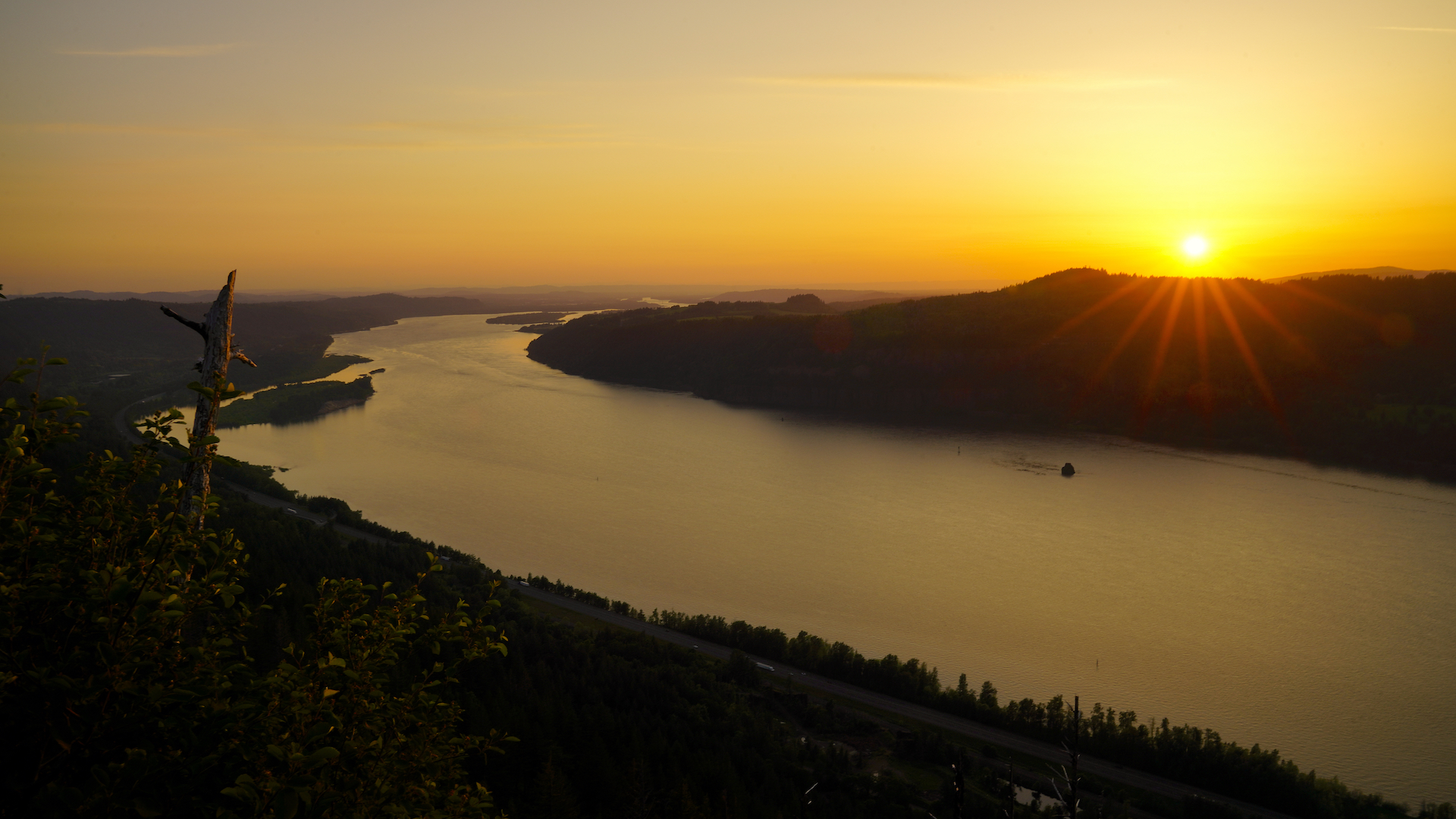
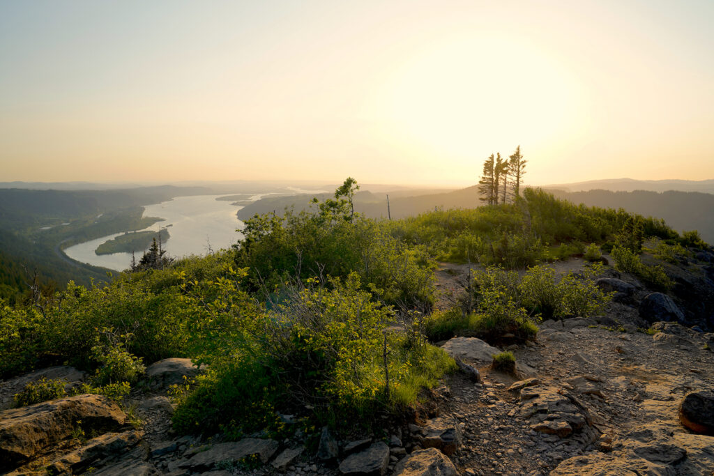
The fourth and final section is also the most challenging. Here the vegetation becomes more alpine-like as trail crosses to the backside of Angel’s Rest where there are some rocky patches to traverse. Watch for poison oak in this section. The connector trail junction to Wahkeena Falls is at the last corner (but is somewhat hard to find). Your first views of the gorge appear between the boulders, but keep going along the ridge line (there are a few small rocks to climb up) to the more open viewpoint on the bluff. The sunset view is fantastic, looking west toward Portland. Also notice Foxglove Falls dropping off the cliffs east of the viewpoint – it is clearly audible and somewhat visible. Mt Adams, Mt St Helens, and other Washington Cascades peaks are visible from the summit. The summit is quite exposed and can be extremely windy.
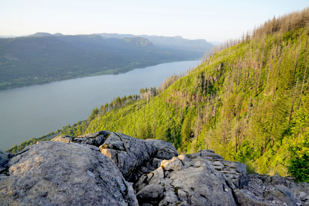
This hike is open year-round, but it can be a doozy in winter when the freezing wind howls through the gorge. Spring is the optimal time, with pleasant temperatures and loads of flowers. In autumn there could be some nice fall color in the burn scar – I expect a lot of yellows. In summer this is a popular morning hike. Throughout the warm season this is one of the most visited Columbia Gorge trails. Overflow parking is available on Palmer Mill Rd, with a second trailhead leading from this parking area and joining the main trail. If it’s hot out this is a better parking area because it has lots of shade. For me this hike was good but not incredible. I found it to be surprisingly long, plus steep enough that I had to stop to rest a few times. The views at the summit, while great, were not astounding. Upper Coopey Falls is the best part of this hike!
One final note – there is a lot of information on the internet about this hike (makes sense due to it’s popularity) but there appears to be little agreement on trail length and elevation gain. Every site reports something different. For this listing I posted averages for these statistics. Just don’t be surprised if you look online and find varying information. In summary, it’s a little less than 5 miles roundtrip with an elevation gain of around 1500 feet.
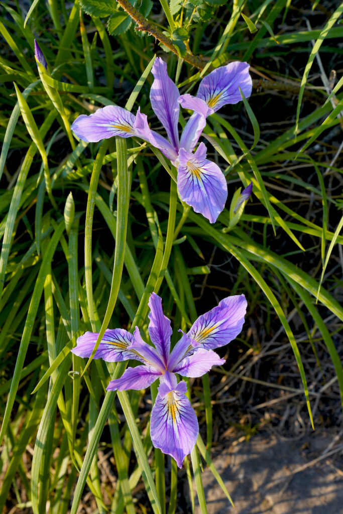
Right: Angel’s Rest Trail features a wide variety of late spring wildflowers, including these less-common Oregon Irises.
Cautions
If you park at the main parking lot please be careful crossing the historic highway and as you pull out of the parking lot. The biggest concern on this hike is the strenuous elevation gain and rocky trail surfaces. This is not a good hike for kids (I saw a few on the trail, they all looked miserable, were upset/crying, or were being carried by adults). Bring ample water! There is a bit of poison oak trailside near the summit. Stay back from the cliff and off of ledges at the summit, and don’t trample the sensitive vegetation as it regrows after the fires. The summit is very exposed and can be extremely windy, especially in late autumn and winter.
Getting There
From I-84 eastbound, take Bridal Veil exit 28 and head down Bridal Veil Road. The trailhead is on the right at the intersection with Historic Columbia River Highway, with additional parking up Palmer Mill Rd (go left up the dirt road past the main parking area).
There is no exit heading westbound, so the best course is to exit I-84 at exit 35, signed for Ainsworth State Park, and head west on the historic highway for 7.5 miles to the trailhead on the right. You’ll pass Horsetail, Multnomah, and Wahkeena Falls en route.
Photographer’s Tip
Just pick a day with good air quality and you’ll be happy! The sunrise view is obscured from the summit, but the sunset view is wide-open – probably best around the spring and fall equinoxes when it will appear to set directly down the gorge. A still day in fall or winter could put you up above the fog. I used a variety of lenses. There are lot of opportunities for wildflower macro photos.
Upper Coopey Falls is beautiful and is one not many photographers shoot. A wide lens is helpful as you will be close the falls – luckily it doesn’t produce much spray. The falls face northwest and have trees growing right from the falls brink so expect even shadow in the morning and dappled sun & shade for the rest of the day, with a few sunspots around in the hour before sunset, especially in late spring and early summer.
Links
https://www.fs.usda.gov/recarea/crgnsa/recarea/?recid=29874
https://stateparks.oregon.gov/index.cfm?do=park.profile&parkId=219
https://www.alltrails.com/trail/us/oregon/angels-rest–3
https://www.oregonhikers.org/field_guide/Angels_Rest_Hike
https://www.wta.org/go-hiking/hikes/angels-rest
https://gorgefriends.org/hike-the-gorge/angels-rest.html
https://www.oregonhikers.org/field_guide/Upper_Coopey_Falls
https://www.waterfallsnorthwest.com/waterfall/Coopey-Falls-4058

