Details
Region: Mid Willamette Valley
Location: 21803 NE Lucia Falls Rd, Yacolt, WA 98675
DEN Rating: 4/10
Trail Length: 400 feet total
Trail Type: out and back
Hike Time: 2 minutes to main falls
Trail Difficulty: easy 3/10, moderate 6/10 to the bottom pool.
Elevation Gain: 20 feet (40 to bottom of falls)
Trail Surface: paved, steps, rock
Popularity: 6/10
Family friendly: yes
Pet friendly: yes
Handicapped Accessible: no
Swimming: yes
Camping: no (yes at 2 nearby campgrounds)
Restroom: vault toilets
Open Hours: day use only (7AM to dusk)
Season: year-round
Pass or Permit: NW Oregon BLM pass or $5 day use pass
Managed By: Bureau of Land Management (BLM)
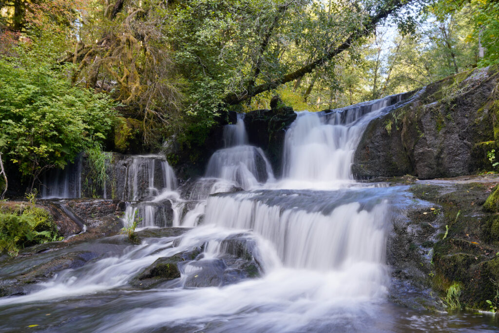
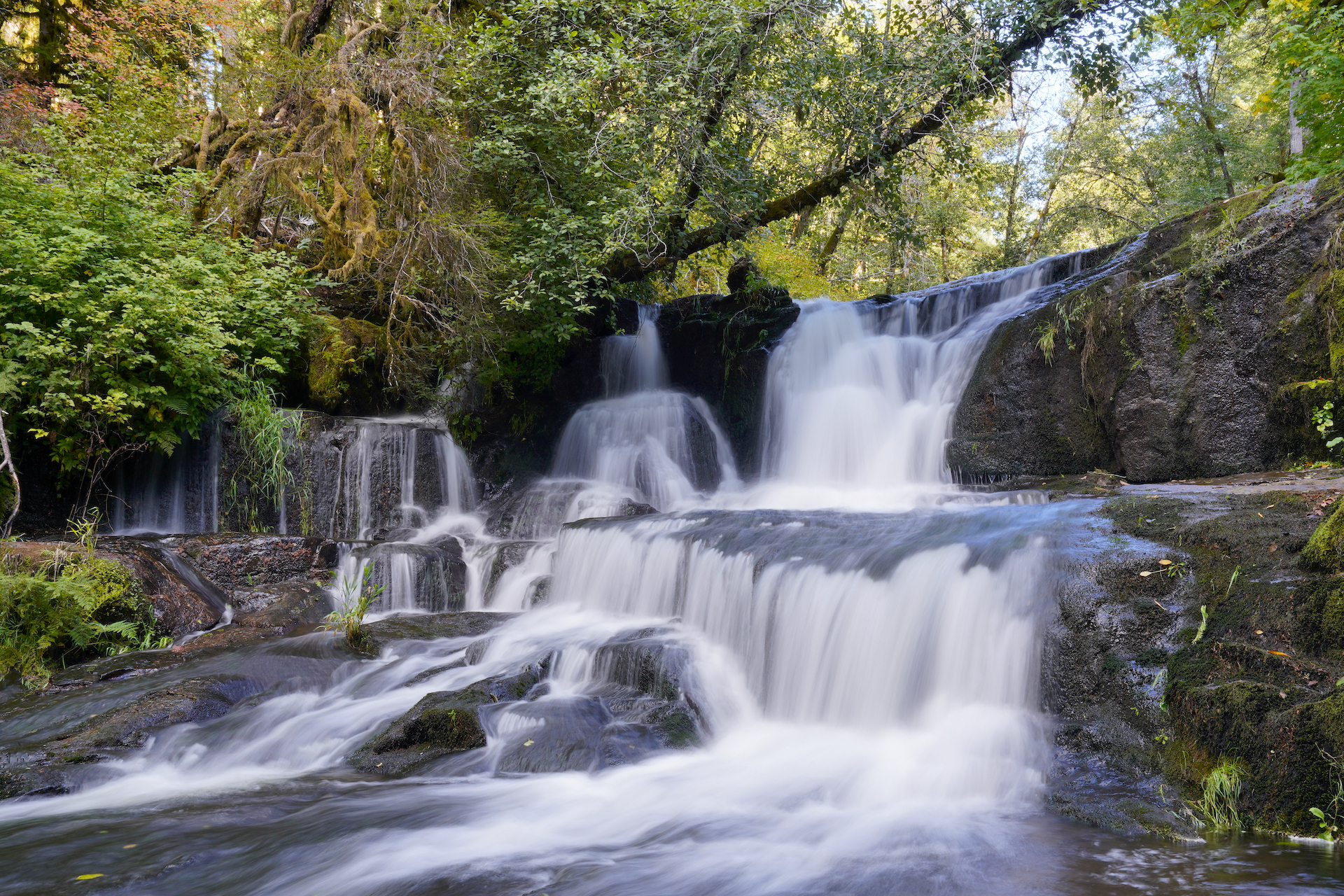
Alsea Falls is a modest set of waterfalls on the headwaters of the Alsea River. I was a bit let down by this one – it has such a big parking area, and well-developed trails that I thought the falls itself would be a bit more spectacular. It was just ok. When I visited it was early autumn and the water level was somewhat low, but even at more moderate flows I don’t picture this one being a show-stopper. Apparently I came at the wrong time of year!
Later in the fall, Alsea Falls becomes a great spot for fishing and for watching the salmon and steelhead try to jump the falls. In winter the falls rage and roar. In late spring the area is filled with rhododendron blooms. And I must agree that the forest in this whole area was extremely pretty. The drive in to the trailhead was magnificent, with shafts of light illuminating the giant fern gardens on the forest floor and big arching clumps of red alder making cool tree tunnels over the road.
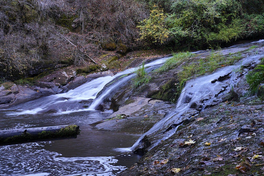
Part of the draw at Alsea Falls is the easy access. The trail is so short that you’ll miss the “hike” if you blink. The main trail lets you out onto the rocks below the main / upper tier of the falls. It’s easy to get right up close to the falls and there’s a fair amount of space for folks to hang out and relax on the smooth rocks. The falls continues by sliding further down the rock and into a small pool. Getting to the very bottom is a little harder – you’ll either need to climb down (and back up) a small wall or follow some steeper scramble paths down through the woods, or just traverse the sloping rock. Unless you’re swimming in the little pool, the bottom part of the falls is not worth the effort.

A popular trail leads across a bridge and down river to another waterfall on Peak Creek. I did not hike this trail when I visited due to time constraints. The hike often rated as easy, but written descriptions and reviews frequently report it as moderate, with some steep parts. From what I can tell the trail has been rebuilt and rerouted a few times recently due to damage, resulting in varying reports of trail lengths and trail conditions. One thing that is certain is this trail will definitely be pretty! Most sites I found online describe this hike which combines the two falls. Since it’s possible to drive to a closer trailhead for Green Peak Falls, I chose to create two separate articles. Check out the Green Peak Falls hike here!
Trails also lead upstream on both sides of the river to Alsea Falls Campground. There are also a plethora of picnic tables scattered around the day use area. There is a second privately-managed campground at the trailhead for Green Peak Falls.
Cautions
There are some steps to get down to the rocks, and the rocks themselves are sloped and slippery when wet. Be cautious. Getting down to the bottom pool is trickier.
Getting There
From the town on Monroe (on Hwy 99W between Corvallis and Junction City), turn west onto Alpine Road and proceed for a little over 9 miles, then continue onto BLM South Fork Road for another mile. Keep left at the intersection to stay on BLM South Fork Rd and continue another 3/4 mile. Drive through the tight curve, then turn left onto Glenbrook Rd and proceed 2.5 miles to the parking area. In this last stretch the road name changes from Glenbrook Rd to Fall Creek Access Rd and then back to BLM South Fork Rd…just follow the main road and you’ll get there!
Passes
You’ll need either an annual NW Oregon Pass from BLM, or you’ll need to pay the $5 day use fee on site. There’s a card reader machine next to the trailhead, and a second sign board and pay station for cash and checks – just display your stub or receipt on your dashboard.
Photograher’s Tip
Explore around the rocks for different angles. The falls face west, with dotted shadows across the scene from the tall forest next to the falls.

Links
https://www.alltrails.com/trail/us/oregon/alsea-falls-trail-green-peak-falls-trail
https://www.oregonhikers.org/field_guide/Alsea_and_Green_Peak_Falls_Hike
https://www.waterfallsnorthwest.com/waterfall/Alsea-Falls-4819
https://www.hikeoregon.net/alsea-falls-and-green-peak-falls.html
Alsea Falls Campground Info
https://www.blm.gov/visit/alsea-falls-recreation-site-campground


