Details
Region: Lower Willamette Valley
Location: off Crooked Finger Rd, SE of Scotts Mills, Marion County, Oregon
DEN Rating: 8/10
Trail Length: 1.4 miles total (if parked at trailhead, up to 5.5 miles total if parked at upper parking area)
Trail Type: out and back
Hike Time: 40 – 60 minutes from trailhead to falls and back, plus additional time if parked further up the road, up to 3 hours total.
Trail Difficulty: fairly difficult 7/10
Elevation Gain: 150 feet, over 1000 if parked at upper parking area.
Trail Surface: rocks and dirt, rock bar along creek, gravel and dirt road
Popularity: 5/10
Family friendly: no
Pet friendly: no
Handicapped Accessible: no
Swimming: yes
Camping: no
Restroom: none
Open Hours: dawn to dusk
Season: April – Nov
Pass or Permit: none required
Managed By: private land (owned by Mt Angel Abbey, Silver Falls Tree Farm)
Select photographs in the article are available as custom prints. Click on the shopping cart icon to see print media and sizing options. Click on the expand icon for a full-screen view of the image.
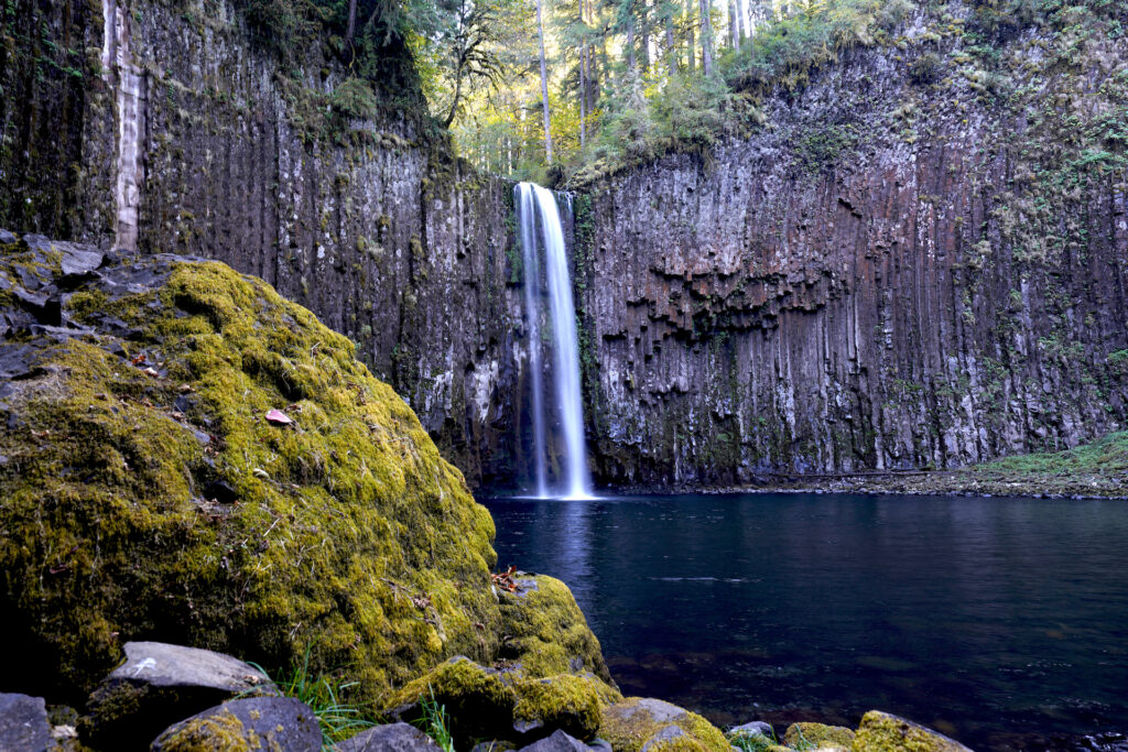
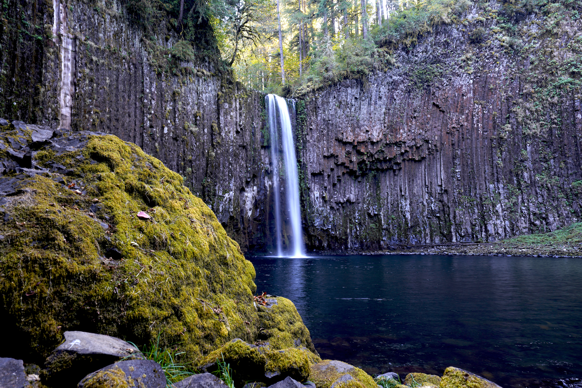
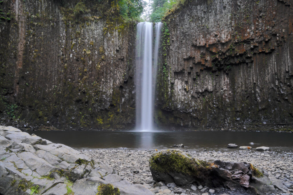
Abiqua Falls is one of the most epic waterfall locations in Oregon. The main falls pour gracefully and cleanly over columnar basalt cliffs into a huge amphitheater where red lichen mixes with mosses and cliff-dwelling plants on the towering stone walls. While the main plunge is a modest 92 feet, the size and depth of the waterfall basin imparts a sense of grandeur. This is one of those awesome places that makes you feel small. The pool at the falls base is gigantic – almost the size of a small lake, meaning there is plenty of space for warm-season swimming. The views from the broad gravel beach across the pool to the falls are clear and perfect.
Word has been out for some time now about how amazing Abiqua Falls is – it’s pretty much impossible not to be wowed by this place and people talk (and share online – this spot was made for Instagram.) As such, even though this waterfall is not on public land and has no official trail, expect there to be people at the falls when you visit, especially on weekends in the dry season.
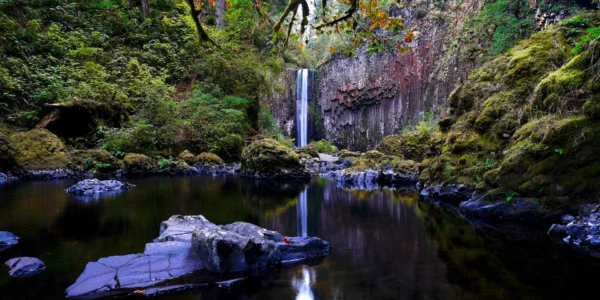
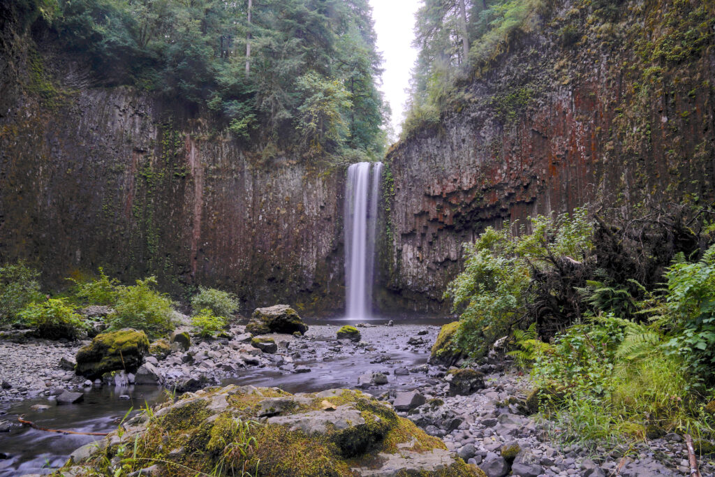
Abiqua Falls Reflection
This shot is from the first of many trips I’d make to Abiqua Falls. After exploring around the main falls pool I journeyed downstream, crossed, then came back up the opposite shore to reach this view looking up the leafy canyon below the falls and the distinctive red cliff face with a nice reflection in … Read more
Abiqua Falls itself is your satisfying reward for the arduous journey it takes to get there and back. The road to Abiqua Falls descends through the expansive Silver Falls Tree Farm timber area. It’s a steep dirt and gravel road with a few spots that require a high-clearance vehicle (4WD in the winter or after heavy rain). If you’re the confident driver of such a ride – congrats, you made getting to Abiqua Falls much easier on yourself. If you have a smaller car you’ll have to park much further up the road and walk in, which means several miles of steep trekking up the road on the way out. Most people park at the upper quarry (there is a prohibitive-looking rough spot on the road that forces you to park), but if you can make it through that one little spot you can drive another mile down the road and park at the second quarry or just beyond, which cuts an hour or more out of the total hike time. Trust me, be brave – my little Chevy Bolt made it down to the second quarry and out with no issue.
The main trail to Abiqua Falls starts on the south (downhill) side of the road a few hundred yards before the lower parking area at the end of the road. Look for a white sign next to the trail – the sign is set back from the road about 30 feet into the woods but is visible, then stay left where you see a dirt road on your right. The first 1/2 mile includes two steep sections with ropes to help you along. The second rope section is quite long. These steep sections get muddy and pretty awful in the wet season, hence my April – November recommendation. Wear good hiking boots, do some stretches, and be prepared to get dirty and sweaty. Personally I would not bring a dog down this trail unless it were a bigger dog that spends time on trails regularly.
Once you reach the creek the hard part is over. To reach the falls, head left once you reach the creek, following the boot path along the water’s edge for another 2/10 of a mile. You’ll pass a really pretty pool just before the falls come into view. In summer and fall this section is fairly easy, especially if you walk on the gravel bar that develops when the water is low. In winter, if the water is high enough, reaching the falls may be impossible without getting wet. There are some low rocks to negotiate right before reaching the open falls basin.
Got some time to explore? Cross the creek where the trail first meets the water and head downstream across the rolling gravel bars – you’ll have to get your feet wet for a second. For the even more adventurous, look for small scramble paths along the road upstream (east) of the main trail. A network of small but decently easy trails lead to various partial views of Abiqua Falls from the canyon rim. One path leads to a 20-foot upper tier of Abiqua Falls – very cool, but a 10/10 in difficulty as reaching the grotto below this upper tier means a 15-foot vertical rope climb. Don’t try it by yourself – if you get injured you will be in real trouble. If you’re able to make it down, the upper tier is really pretty plus you can look over the top of main Abiqua Falls. Yet another side trail further upstream descends down some rocks, then travels above the slot canyon the creek passes through above the waterfalls. The forest in this entire area is really pretty.
A second boot path leads to Upper Abiqua Falls, about 1/2 mile above the main falls. Find this trail at a small turnout that’s across the road from a muddy and torn-up OHV track – listen for the sound of a waterfall. Personally I would only try this one when the trail is dry – in the wet season it’s slippery, steep in spots, and the trail has collapsed in a few small sections. I was hiking solo when I tried it and found it a little too treacherous to feel comfortable so I turned around about 100 feet past the first small trail collapse. I do intend to try this trail again in dry conditions as I really want to check out Upper Abiqua Falls!
Abiqua Falls is absolutely worth the effort it takes to reach it (and get back to your car). The entire scene is magnificent, grand, and extremely photogenic. In the wet season you’ll witness a powerful plunge creating clouds of mist, while in the late summer you’re greeted by a graceful silver strand and a calm pool. For me this waterfall is definitely on the Oregon Top 10 waterfalls list. Give yourself a full day here (bring a picnic) so you can really spend some time at the falls and have time to take a more leisurely pace getting to and from the falls. If you visit, please be extremely respectful of the land. The falls are on land owned by Mt Angel Abbey, who graciously allows public access to this beautiful place. Pack it in, pack it out – leave no traces please!
Cautions
The steep trail with ropes is the biggest challenge. Remember you have to climb back up, so stop on the way down and turn around if it seems too difficult. If you’re vehicle cannot make it to the end of the road you’ve got a long, steep hike to get back to where you parked – it feels like you’re hiking uphill FOREVER. Do not drive down the road in a less-than-reliable vehicle. Pull over and park if you’re not confident that you and your vehicle can negotiate the road. Give yourself a lot of time to do this hike, as road conditions change and you may find yourself having to hike several miles further than you planned. Bring water! And if you’re visiting in the summer wear sunscreen as there is no shade in the waterfall basin. Also bring a flashlight, especially if you parked at the upper parking area – I stayed longer than I meant to and wound up hiking back in the dark. Thankfully there are no vertigo-inducing cliffs or dropoffs trailside on this hike, and there is also no poison oak.
Swimming Hole Info
This is the waterfall swimming hole of your dreams (as long as you dream of refreshingly cold water). The pool is huge and easy to enter from the gravel beach, with a gradual walk into the deep center. When the falls are running low in late summer you can swim right up to and even slightly behind the falls. The second pool just below the main waterfall pool is also swimmable, with a possible 10-foot jump off the rocks on the south side of the pool – check the depth before you jump!
- summer water temp: cold 60F-68F
- water clarity: 6-10ft
- color: jade green
- Depth: 20-40ft
- Current: 0
- Shoreline & stream bottom surface: pebbles
Getting There
From the town of Scotts Mills, head east on Crooked Finger Rd NE for 13 miles (the last two miles are decent gravel road). Near the end you’ll enter a drastic clearcut area with a few mature trees left standing – it’s odd. This area is popular with four-wheelers and other ATV’s so watch for them on the road. Turn right at the rec area sign board (if you reach a gate on the main road you’ve gone about 1/2 mile too far) and follow this smaller gravel road for about 4/10 mile.. Park in the obvious gravel quarry on the right just before a bad patch in the road. If you feel your car can make it past this, then proceed down the road about a mile to the second quarry on the right, or just past it to the small turnouts on the right where the road bends left. The road gets much worse where you see a tree spraypainted with markings on the left – do not go past here without a high clearance vehicle (4WD in the winter or when it’s wet out). It’s about 2 miles of walking down the road from the upper parking area to the trailhead, then another 7/10 mile to the falls. Full disclosure – the hike back up the road is a monster.
Photographers Tip:
The falls face west in an open stone amphitheater so a neutral-density filter is necessary for long exposures on sunny days, especially in late spring and summer when the sun angle is high. Expect backlighting in the morning. Move around the area for different views. The cliffs are what makes this spot so epic. In the wet season the falls becomes wider and powerful (and produces a lot of mist), but it keeps it’s graceful form year-round and still looks good when the water is low. There are not a lot of deciduous trees so this is not the spot for fall color.
Notes
The nearby Butte Falls waterfall series on Butte Creek is closed due to extensive fire damage (fire was summer 2020, area still closed as of Sept 2023).
There are a lot of discrepancies between websites about elevation gain, trail length, etc. I’ve gone with what felt correct to me out of the various stats.
Links
https://www.alltrails.com/trail/us/oregon/abiqua-falls-trail
https://www.oregonhikers.org/field_guide/Abiqua_Falls_Hike
https://www.outdoorproject.com/united-states/oregon/abiqua-falls
https://www.waterfallsnorthwest.com/waterfall/Abiqua-Falls-4437
https://www.theoutbound.com/oregon/hiking/short-hike-to-abiqua-falls
